Trip
Summit 2026 – Mt Bierstadt via West Slopes
A special commemoration of 250/150 on Colorado Day to summit the state's 14ers.
Contacts


- Sat, Aug 1, 2026
- Summit 2026
- Hiking
- Adults
- Moderate
- Mileage: 7.25 mi
- Elevation Gain: 2,850 ft
- FULL, 14 on waitlist (11 capacity)
- FULL (2 capacity)
- Cancellation & Refund Policy
All participants and leaders are REQUIRED to sign the State of Colorado's liability waiver. Please click here to fill out the waiver.
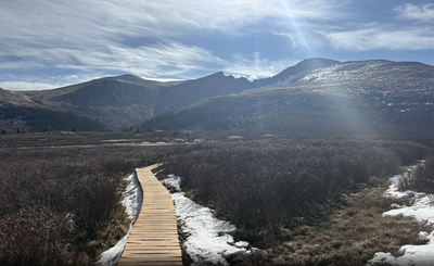
Locate the Bierstadt Trail and begin by descending east toward Scott Gomer Creek. Navigate through willows on wooden bridges and trail sections for nearly a mile to reach the creek , near 11,500'. Cross the creek and continue through the willows as you approach Bierstadt's west slopes. Near 11,800', switchback up a steep slope and exit the willows. You'll then reach flatter terrain, near 12,300', on the north end of a shoulder.
With the remainder of the route now in view, hike southeast up the shoulder. Pass an overlook at 12,600' and continue higher. Around 13,000', the terrain becomes noticeably steeper. Follow the well-defined trail and zigzag your way up to a ridge crest, at approximately 13,750'. Walk northeast to the base of the final pitch. While the summit may not yet be visible, only 250 feet of elevation gain remains. This final section is the crux of the route and the reason it earns a Class 2 difficulty rating. Without a trail, navigate your way through the boulders, staying on or just left of the ridge crest. When the terrain eases, walk a short distance further to reach the summit.
IMPORTANT: This route enters the Mount Evans Wilderness area. Designated wilderness areas have special regulations and restrictions for party size, dispersed camping, campfires, etc. If you have questions about the wilderness area, please contact a U.S. Forest Service office.
For questions about your trip, please reach out to your trip leaders directly. For general questions about the Summit 2026 project or any relate event, please reach out to summit2026@cmc.org.
Parking is extremely limited and will fill up. Please plan to carpool and arrive early to snag a spot - even before 6am if possible!
Meet in the upper parking area at 6am. We will leave the trailhead at 6:30am to start the hike. Please carpool if possible.
From the north: Take the Georgetown exit off of Interstate 70. Drive through Georgetown and follow the signs for the Guanella Pass Scenic Byway. Drive 12 miles to the top of Guanella Pass (11,700') and park in one of the two large, paved parking areas on either side of the road. The Bierstadt trail starts near the parking area on the east side of the road. The upper parking area (on the west side of the pass) has restrooms.
From the south: Take US 285 west from Denver or east from Fairplay. Drive to the town of Grant which is about 12 miles west of Bailey. In Grant, turn north on the Guanella Pass Scenic Byway and drive approx. 13 miles to Guanella Pass.

Required Equipment