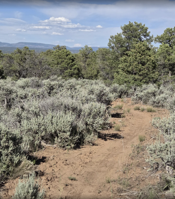
Burn Canyon Trail System
Southwest of Norwood, providing access to the Burn Canyon MTB trails and the McKee Draw hiking trails.
Beautiful views of deep canyons with large cottonwoods and junipers, as well as mesa tops with panoramic views of Lone Cone Mountain, the La Sal Mountains of Utah, and the majestic San Juan Mountains.
The Burn Canyon Trail System is managed by BLM's Uncompahgre Field Office. See the BLM page for suggestions on trail combinations and detailed driving directions. For office hours and directions, call 970-240-5300.
CoTrex is handy for seeing names and info on individual trails. Alltrails suggests trail combinations and has user trail reports.
Alternate Titles:
McKee Draw TH - for hikers
Burn Canyon Loops TH - for bikers
- Suitable Activities: Biking, Hiking
- Seasons: May, June, July, August, September, October, November
- Weather: View weather forecast
- Land Manager: Bureau of Land Management
- Parking Permit Required: BLM Permits & Passes
- Recommended Party Size: 12
- Maximum Party Size: 12
- Maximum Route/Place Capacity: 12
This is a list of titles that represent the variations of trips you can take at this route/place. This includes side trips, extensions and peak combinations. Not seeing a title that fits your trip? Log in and send us updates, images, or resources.
- Burn Canyon Trail System - McKee Draw TH, 9/1178'
- Burn Canyon Trail System - Burn Canyon Loops TH
There are no resources for this route/place. Log in and send us updates, images, or resources.