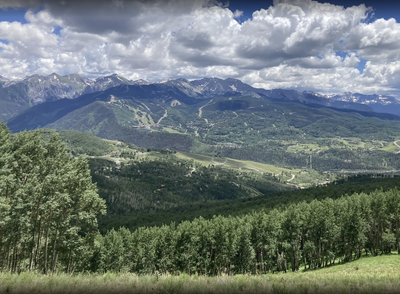
Deep Creek Trailhead
Trail system above Telluride that can be an access to Mt Sneffels Wilderness. It is the starting point for Deep Creek Trail and for a network of trails to the south
Alternate Titles:
Deep Creek Trail -#418 - Out and Back - 14.7 miles, 3671' gain
Deep Creek Trail #418 to Whipple Mountain Trail to Iron Mountain Trail #419.1 C&D to Iron Mountain Basin - 8 miles, 2000' gain
Whipple Mountain Trail #419 one-way from Deep Creek TH to Whipple Mountain TH - 8 miles, 3344' gain
Penelope's Trail, Aldasoro Trail, and Remine Creek Trail form a single, continuous downhill trail from the Deep Creek TH to CO-145 and the Lawson TH - one way 4.4 miles, 542' gain
- Suitable Activities: Backpacking, Biking, Hiking
- Seasons: May, June, July, August, September, October
- Weather: View weather forecast
- View avalanche forecast.
- 12,000 ft
-
Land Manager:
U.S. Forest Service
Mount Sneffels Wilderness Area, Norwood Ranger District (GMUG)
- Parking Permit Required: USFS Permits & Passes
- Recommended Party Size: 12
- Maximum Party Size: 12
- Maximum Route/Place Capacity: 12
- CoTrex
- AllTrails
- Hiking & Walking
This is a list of titles that represent the variations of trips you can take at this route/place. This includes side trips, extensions and peak combinations. Not seeing a title that fits your trip? Log in and send us updates, images, or resources.
- Deep Creek TH - Deep Creek Trail #418
- Deep Creek TH - Iron Mountain Trail #419.1 C&D
- Deep Creek TH - Whipple Mountain Trail #419
- Deep Creek TH - Penelope Trail
There are no resources for this route/place. Log in and send us updates, images, or resources.