IPW - Brainard Ridge
moderate hike with a distance of about 6.5 miles and an elevation gain of about 1700 feet. The moderate rating is due to the steepness. It ascends to the high point of the ridge, where there are spectacular views of the Brainard area.
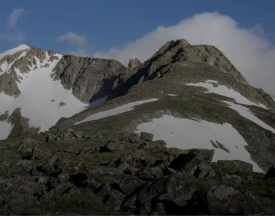
The hike begins at the Long Lake TH. At Long Lake, the route goes off-trail, and ascends very steeply through forest. At treeline, there's an ascending traverse to the flat top of the lower part of the ridge. This is mostly on tundra, although part of it goes through rocks. Then there's an ascent on solid talus and grassy areas to the top, which has amazing views of Lake Isabelle, Blue Lake, and the entire Four Lakes area.
Then, a descent back to the lower part of the ridge, and down the Blue Lake side, which is not forested. On the descent, there are great views of Mt. Toll, from an unusual angle. The Blue Lake outlet stream must be crossed, which can be done on rocks later in the season, but earlier will need to be waded. There's only one reasonable place to cross it. This area is prime moose habitat, so binoculars can be useful for safety.
The stream crossing is right next to the Blue Lake Trail, which is the route back to the trailhead.
See Summit Post for a discussion of this route. This is NOT a peak-bagger hike but on the east ridge of Little Pawnee Peak (12,466').
- Suitable Activities: Hiking, Scrambling
- Seasons: June, July, August, September, October
- Weather: View weather forecast
- View avalanche forecast.
- Length: 6.5 mi
- Elevation Gain: 1,700 ft
- 12,466 ft
-
Land Manager:
U.S. Forest Service
Indian Peaks Wilderness Area, Boulder Ranger District (ARNF)
- Parking Permit Required: USFS Permits & Passes
- Recommended Party Size: 7
- Maximum Party Size: 7
- Maximum Route/Place Capacity: 7
- SummitPost
- CoTrex
There are no resources for this route/place. Log in and send us updates, images, or resources.