IPW - Devils Thumb Pass via Fraser
The trail starts outside of Fraser and connects to the High Lonesome Trail which is part of the Continental Divide Trail.
IPW restrictions for permits, parking, and entry vary by season and trailhead. Go here for current information.
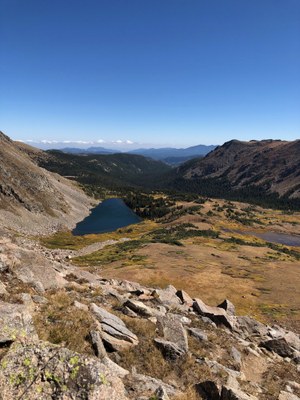
This is a challenging out and back hike, 7.6 miles roundtrip, and elevation gain 2300 feet. This trail located in the Indian Peaks Wilderness area on the west side of the continental divide. There are several creek crossings on the first miles, then the trail becomes steeper, and final mile takes us to the pass (elevation 11747) where we can see Devils Thumb Lake below.
- Suitable Activities: Hiking
- Seasons: June, July, August, September
- Weather: View weather forecast
- View avalanche forecast.
- Difficulty: Diff B
- Length: 7.6 mi
- Elevation Gain: 2,300 ft
- 11,747 ft
-
Land Manager:
U.S. Forest Service
Indian Peaks Wilderness Area, Boulder Ranger District (ARNF)
- Parking Permit Required: USFS Permits & Passes
- Recommended Party Size: 12
- Maximum Party Size: 10
- Maximum Route/Place Capacity: 12
- Trails Illustrated 103
- AllTrails
- CoTrex
There are no resources for this route/place. Log in and send us updates, images, or resources.