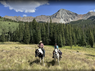
Lone Cone Peak
"The Sentinel of the West End," Lone Cone Peak (12,614') is a solitary, extinct volcanic peak and the westernmost major mountain of the San Juan Range, located near the town of Norwood.
The summit and trail offer sweeping scenic views of the surrounding San Juan Mountains and Dolores Peak.
The Lone Cone Trail (#426) is a challenging out-and-back hike that ascends along East Beaver Creek. It is often rated as a black diamond/hard difficulty due to loose scree and steep, rocky sections near the summit - 11.2 miles, 2400' gain
Off-trail exploration is another option. One enjoyable trip is to scramble up the northeast ridge, and then a hike back down the north ridge - 4 miles, 2000' gain
AllTrails reports a climb travels up through aspens and pine forests, and past small ponds and creeks. This is a great place to experience Colorado's subalpine ecosystems, where you'll get to see a variety of wild and plant life, including spring and early summer wildflowers
Cabin Stays: Near the base of the peak at 9,200 feet, the historic USFS Lone Cone Cabin is available for rental, offering great views of the mountain and night skies. You can book your stay via Recreation.gov.
Access the area via the CR 44ZS Lone Cone Road.
- Suitable Activities: Hiking, Scrambling
- Seasons: June, July, August, September, October
- Weather: View weather forecast
- View avalanche forecast.
- 12,613 ft
-
Land Manager:
U.S. Forest Service
Lizard Head Wilderness Area, Norwood Ranger District (GMUG)
- Parking Permit Required: USFS Permits & Passes
- Recommended Party Size: 6
- Maximum Party Size: 12
- Maximum Route/Place Capacity: 12
- COTREX
- AllTrails
- AllTrails
This is a list of titles that represent the variations of trips you can take at this route/place. This includes side trips, extensions and peak combinations. Not seeing a title that fits your trip? Log in and send us updates, images, or resources.
- Lone Cone Peak - Lone Cone Trail
- Lone Cone Peak - Off-Trail Scramble
There are no resources for this route/place. Log in and send us updates, images, or resources.