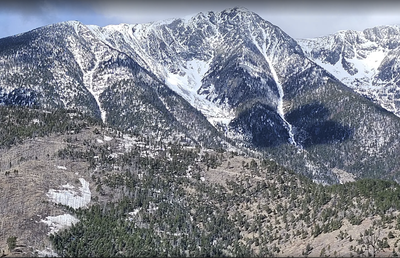
Table Mountain Viewpoint
Moderately challenging hike on and off the Rainbow Trail with some rocky spots through aspens and pines southwest of Coaldale. 4.5 miles and 1300 ft.
The trip originates at the Hayden Creek TH and uses a segment of Rainbow Trail #1336 until you pick a spot to go off-trail toward Table Mountain (9,340').
To get to the TH, take Highway 50 in Coaldale, watch for a sign that says "National Forest Access, Hayden Creek." Turn at the sign onto County Road 6 and continue for 4.3 miles to the trailhead. When driving up FR 6, look for the US Forest Service Rainbow Trail #1336 sign and parking turnouts on the right (northwest) side of the road. AllTrails has a map and partial gpx track.
- Suitable Activities: Hiking
- Seasons: Year-round
- Weather: View weather forecast
- View avalanche forecast.
- Length: 4.5 mi
- Elevation Gain: 1,300 ft
- 9,000 ft
-
Land Manager:
U.S. Forest Service
Sangre de Cristo Wilderness Area, Salida Ranger District (PSINF)
- Parking Permit Required: USFS Permits & Passes
- Recommended Party Size: 12
- Maximum Party Size: 12
- Maximum Route/Place Capacity: 12
Upcoming Activities
Past Activities
Map
- AllTrails
- CoTrex
- USFS
Trip Reports
Resources
There are no resources for this route/place. Log in and send us updates, images, or resources.