Trip
Ascending Hikes – Bottle Peak and Ptarmigan Loop
We will hike up to Bottle Pass, Bottle Peak and Ptarmigan Peak starting from the Beyers Peak trailhead
- Fri, Jun 20, 2025
- Ascending Hikes Section
- Hiking
- Adults
- Moderate
- Mileage: 8.0 mi
- Elevation Gain: 2,200 ft
- High Point Elevation: 11,796 ft
- Pace: 1.5-2.0
- 3 (8 capacity)
- FULL (2 capacity)
- Cancellation & Refund Policy
Leader's notes
NOTE **** This hike is dependent upon the opening of the Beyers Peak Road which typically opens on June 15th.
Status of the Road Opening can be found under the Sulphur Ranger District Status Page here:
https://www.fs.usda.gov/r02/arp/conditions
Overview:
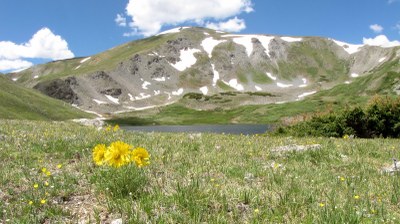
A beautiful hike in an area that fewer people visit near Fraser in the Byers Peak Wilderness.
The Second of three progressively more difficult hikes - More distance (7.5 - 8 Miles) and Elevation gain (2000-2500 depending upon route) , and higher elevations - from 10K-nearly 12K ft.
Bring your ten Essentials. Sun protection is essential. Plenty of water - there is no potable water source on the trail.
Good Balance and Stability is essential on this hike: You should not need hiking poles to negotiate rocks. If you need hiking poles to step up or down rocks or other small obstacles then this is not the proper hike for you and the leader may ask that you check out of the hike. Hiking poles are ok, just not if needed for balance or support at all times.
Some of this hike will involve off trail navigation suitable for beginners.
Leader will send out Trip note updates approximately 1 week and 2 days ahead of the hike.
We will meet at the Colorado Mountain Club Parking Lot (the new facility at 32nd and McIntyre Street in Golden) at 5:30 AM for a 5:45 AM departure and Carpool from there. Travel Time to the Trail Head Near Fraser is approximately 2.0- 2.25 hours. Our Goal is to get an early start to beat any afternoon thunderstorms.
Required Equipment
10 essentials, Waterproof Boots, Hiking pole(s) or stick will be helpful. A modern Navigation Device that can read gpx files: i.e. a smartphone device like an iPhone or android compatible phone loaded with the GaiaGPS (recommended app), CalTopo, CoTrex or equivalent.
