Trip
Ascending Hikes – Coffintop Mountain from Button Rock TH
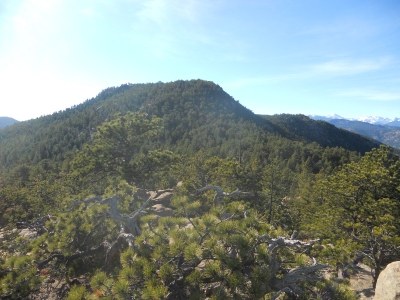
This rugged out-and-back hike takes you from the low-lying canyon along North Saint Vrain Creek up into the secluded backcountry of Roosevelt National Forest to the summit of Coffintop Mountain (8,049 ft.). Starting at the Button Rock Trailhead, you begin on Longmont Dam Road before ascending either the Sleepy Lion Trail. From there, the route leaves the designated park maintenance trails and follows an unmaintained, off-trail social route up the forested northeast ridge to the summit of Coffintop Mountain (6.8 miles, +-2,199 ft.).
Contacts


- Sun, Nov 15, 2026
- Denver
- Hiking
- Adults
- Moderate
- Mileage: 6.8 mi
- Elevation Gain: 2,199 ft
- High Point Elevation: 8,049 ft
- Pace: 1.5 - 2.0 MPH
- FULL, 6 on waitlist (6 capacity)
- FULL (2 capacity)
- Fri, Oct 30, 2026 at 5:00 PM
- Sat, Nov 14, 2026 at 5:00 PM
- Cancellation & Refund Policy
NOTE: I've created a CalTopo map for thee hike ... You can access it using this LINK.
NOTE: W/respect to lunch ... I would like to make Andrew Skurka's "Beans + Rice with Fritos & Cheese" as a group ... If you like to join in on the "group" meal on the summit of Coffintop Mountain that would be great ... Please text me (303-819-8812) and I'll add you to the list.
Route Breakdown & Itinerary
-
Leg 1: Button Rock Trailhead to Sleepy Lion Trail Junction
-
Path: The hike begins at the Button Rock trailhead, heading out along the wide, gravel Longmont Dam Road as it contours above North Saint Vrain Creek.
-
Transition: Soon, you will intercept the junction for the Sleepy Lion Trail branching off to the left, which climbs up away from the riverbed into the rocky foothills.
-
-
Leg 2: Sleepy Lion Trail to the Eastward Road (Hale Ranch Area)
-
Path: Ascend the rolling terrain of the Sleepy Lion Trail until it connects with the service/maintenance road heading east toward the Hale Ranch Open Space boundary area.
-
Navigation: Follow this road for a short, manageable distance while keeping a sharp eye out for the off-trail turnoff.
-
-
Leg 3: The Social Path to Coffintop Mountain Summit
-
Path: Turn right onto the unmaintained social path/ridge route heading toward the summit.
-
Terrain: This final push requires solid route-finding, careful footing, and Class 2 scrambling through granite outcrops and forested slopes until you reach the 8,049-foot high point.
-
Meet at the RTD - US 36/McCaslin Park-N-Ride, Superior, CO (Driving Directions from Denver) @ 6:30 AM ...
Please call/text Craig Townsend at (303) 819-8812 if you are running late.
Required Equipment
10 essentials.