Trip
Hiking – Ben Tyler Trail - North/Ben Tyler TH
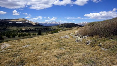
A moderate hike entirely on-trail. A gradual climb with some mild switchbacks at the start. The trail starts out in the full sun, then enters aspen forest, following the creek much of the way,
- Wed, Aug 13, 2025
- Rocky Mountain Over the Hill Gang
- Hiking
- Adults
- Moderate
- Mileage: 7.0 mi
- Elevation Gain: 2,030 ft
- High Point Elevation: 10,200 ft
- Pace: 2.0 average
- 2 (10 capacity)
- FULL (2 capacity)
- Cancellation & Refund Policy
We'll enjoy a beautiful gradually climbing hike on a sometimes rocky trail, to a stream crossing at about 10,200', have lunch and return the way we came.
We'll make a comfort stop at the Loaf N Jug, 173 Bulldogger Rd., (just before) Bailey. https://maps.app.goo.gl/g1HjBbZknWLzgsW5A
We'll then proceed on 9.8 more miles to the Ben Tyler TH, on the left side of the road. https://maps.app.goo.gl/XLeagsy6TprZGXcj8
The RT carpool is 72 miles. 72 x .34 = $24
Meeting Time: 6:30 am to minimize hiking in the heat and to get parking places.
Meeting Place for Carpooling: Morrison PnR (3485 S. Rooney Rd, Morrison, CO) https://maps.app.goo.gl/dWLggRd216Pz6se38. We'll sort carpools by who may want to stop for after-hike refreshments st the Snowpack Tavern.
We will then hop back on C-470 south and get off at the next exit, US-285 south.
Required Equipment
10 essentials, layered weather-appropriate attire.
