Trip
Hiking – Kenosha Pass East
Hike along Forest Service Road 126 to an overlook at 11,060 ft elevation.
- Wed, Oct 2, 2024
- Rocky Mountain Over the Hill Gang
- Hiking
- Adults
- Moderate
- Moderate
- Mileage: 8.1 mi
- Elevation Gain: 1,150 ft
- High Point Elevation: 11,060 ft
- Pace: Moderate (1.8 - 2.0 avg moving speed)
- FULL, 2 on waitlist (6 capacity)
- FULL (2 capacity)
- Cancellation & Refund Policy
The trailhead for this hike is at the “Kenosha East Campground” parking area, about ¼ mile east of Kenosha Pass. Here’s a Google Maps link for the trailhead: https://maps.app.goo.gl/bpBjY9TS9ZGjVr339
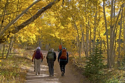
This is an out and back hike on Forest Service Road 126 through the aspen forest to an overlook at 11060 feet. We will be stopping to take pictures and to enjoy an autumn day in the mountains. The fall colors should be close to their peak.
We will meet at the “Morrison PnR (the Park and Ride lot at the intersection of Morrison Road and Rooney Road, in front of the Phillips 66 gas station) at 6:40am so we can form leave no later than 6:50am. Here’s a Google Maps link to the Morrison PnR: https://maps.app.goo.gl/Dh8krPrDnCJBK5Y76
Required Equipment
Bring good shoes, have good sun protection (a brimmed hat, sunglasses, and sunscreen, 2 – 3 liters of water, and hiking sticks (if you use them).
