Trip
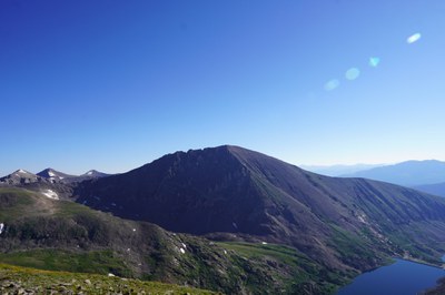
Leader in Training (LIT) Trip – Quandary Peak - South Gully aka Cristo Couloir
this is a LIT and TTL for Ben Galick, open to Glacier Travel students for team training
- Sun, May 11, 2025
- Denver
- Hiking
- Intermediate Alpine Climb
- Adults
- Chalenging
- Moderate
- Mileage: 6.5 mi
- Elevation Gain: 3,400 ft
- High Point Elevation: 14,268 ft
- Pace: 1,000 ft/hr
- FULL (8 capacity)
- FULL (2 capacity)
- Cancellation & Refund Policy
- Description: Route is a Class 2 climb, with moderate exposure and route-finding, Considerable rockfall potential, and Low commitment.
- D9: Slopes probably around 45 degrees. Crux sections are short.
- R3: Route probably has sliding fall potential if snow is firm, moderate amount of obstacles or features that could cause injury, or moderate exposure to rockfall, tributary avalanches and other dangers.
-
Caltopo Links and Route Info
https://caltopo.com/m/PJ0PC
RECENT TRIP REPORTS/CONDITIONS
https://www.14ers.com/php14ers/peakstatus_peak.php?peakparm=10013
TBD
some might sleep at TH
- Trailhead: Quandary Peak Trailhead: https://maps.app.goo.gl/P89XUdZc3NiiaPqq6
others can car pool from woolly mammoth
Badges
leaders will earn:
Required Equipment
10 essentials
|
Day pack |
35+ L |
|
Crampons |
Hybrid or Step-in; bring carrier |
|
Helmet |
|
|
Avy gear: Beacon, shovel, probe |
|
|
Snowshoes |
|
|
Trekking Poles |
|
|
Mountaineering sunglasses / goggles |
|
|
Gaiters |
|
|
Sunscreen |
|
|
Lip balm |
|
|
Personal Hygiene needs |
|
|
Water bottles |
2L / bottles that won’t freeze. NO hoses/water bladders |
|
Baselayer shirt + pants |
|
|
Mid layer shirt |
|
|
Winter pants |
|
|
Insulation layer / puffer |
|
|
Hard shell |
|
|
Hiking socks |
|
|
Sun hat / cap |
|
|
Gloves - winter pair |
|
|
Gloves - lighter pair |
|
|
Balaclava / buff / Neck gaiter |
|
|
Mountaineering boots |
|
|
Snacks |
~6 bars (1 / hr) |
|
Lunch & Salty snacks |
~3 snacks |
|
Headlamp |
|
|
First aid kit |
Bandaid, gauze, tape, antiseptic wipes, antibacterial ointment, painkillers, insect repellent |
|
Knife / multi-tool |
|
|
Compass |
W/ declination + mirror |
|
Hard copy map |
|
|
GPX tracks / offline maps downloaded on Phone |

 CMC Trip Leader School