Trip
Scramble – Lenawee Mountain
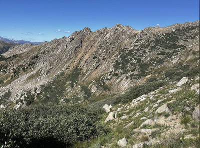
Lenawee Traverse, Grizzly D to Chihuahua Lake Loop. This will involve a traverse with some good exposure so please don't let this be your first class 3!
- Sat, Oct 7, 2023
- Denver
- Scrambling
- Adults
- Difficult D
- Difficult
- Mileage: 10.9 mi
- Elevation Gain: 4,400 ft
- High Point Elevation: 13,333 ft
- Pace: 1000 ft/hr
- 1 (6 capacity)
- Cancellation & Refund Policy
I will be requiring everyone to contact me for permission to join. When you contact me, please include your outings this summer. I'm looking for people that have recently done longer mileage and have experience with more technical terrain (although no ropes or anything are required for this).
Note: The link located in the title was the default for this trip. It has good pics but we will go from Lenawee to Grizzly instead (which is the link I posted in the details.)
Here's a "generic" gpx I generated for what it's worth, although, TBH, kind of hard to get lost in that area if you've been there before.
https://www.gaiagps.com/map/?loc=13.9/-105.8471/39.6062&pubLink=xNfzJwU9vnDGkglYEBJyU8ej&trackId=518d67be-4629-446b-b925-a135a5df439f
I plan on starting from the Lenawee TH but would like to meet up for carpools at Wooly Mammoth BB (right across from the old gas station) to make parking easier. This trip is obviously very weather dependent, meaning, I won't be doing this traverse if we've had a snow storm come through! This will be a challenging hike/climb and should not be your first scramble.
Here's a link to someone that has done this trip (we will be going the same direction, Lenawee first): https://www.stavislost.com/hikes/trail/lenawee-mountain-grizzly-peak-and-chihuahua-lake-loop
From the Forest Service website (https://www.fs.usda.gov/recarea/whiteriver/recreation/recarea/?recid=40959&actid=104#:~:text=Follow%20Montezuma%20Road%20for%20approximately,side%20of%20Peru%20Creek%20Road.) "From I-70 take Exit 205, Silverthorne/Dillon, and travel east on HWY 6 toward Keystone. Just past Keystone, turn right onto Montezuma Road (County Road 5). Follow Montezuma Road for approximately 4.6 miles and then turn left onto Peru Creek Road (FDR 260). Follow Peru Creek Road for approximately 2.0 miles to the Lenawee Trailhead which will be on the left side of the road. Please park along the side of Peru Creek Road."
I think this will take us around 8 hours, maybe less depending on how the traverse goes. I'd like to be moving by 6:30AM so let's be at the TH by 6:20 and Wooly for carpools by 4:45.
Required Equipment
- Ten Essentials
- Extra layers for warmth
- Climbing Helmet
- Carpool Money
