Trip
Summit 2026 – Castle Peak and Conundrum Peak
A special commemoration of 250/150 on Colorado Day to summit the state's 14ers.
Contacts

- Sat, Aug 1, 2026
- Summit 2026
- Hiking
- Adults
- Challenging
- Mileage: 14.2 mi
- Elevation Gain: 9,800 ft
- 5 (5 capacity)
- 1 (2 capacity)
- Cancellation & Refund Policy
All participants and leaders are REQUIRED to sign the State of Colorado's liability waiver. Please click here to fill out the waiver.
Plan on a full day, 8 to 12 hours car to car depending on where the group parks.
Suggested start times (the goal is summiting Castle by 8 to 9 am and being off both summits before noon, since Elk Range thunderstorms build fast over fully exposed ridgeline):
If parking low at the creek crossing (~10,200', the call for most vehicles), be walking by 3:30 to 4:00 am. Round trip about 14.5 miles, roughly 4,850' of gain, 10 to 12 hours.
If a capable high clearance 4WD reaches the 12,800' road end, start around 5:00 to 5:30 am. Round trip about 8 miles, roughly 3,350' of gain, 7 to 9 hours.
Hard turnaround time regardless of summit progress: noon.
Required Skill and Fitness Level
Skill: Difficult Class 2 with short sections of easy Class 3 scrambling on the Castle northeast ridge and the Castle-to-Conundrum traverse. Participants should be comfortable with sustained loose talus and scree, route finding on a non-obvious ridge, and using hands for balance on exposed rock. Prior Class 3 fourteener experience is strongly recommended. This is not a beginner peak.
Fitness: High. Participants need the conditioning for a long day at altitude (summits above 14,000'), 3,350' to 4,850' of gain, and several miles of rough road and talus. Comfort moving steadily for 8 to 12 hours is essential.
General Description (Terrain, Exposure, Scrambling, Gear, Hazards)
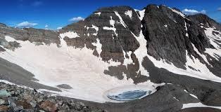
The day starts on a rough 4WD road up Castle Creek into Montezuma Basin. Above the 12,800' road end, a steep 500' headwall that often holds snow into summer leads to the upper basin. From there a climber's trail gains the northeast ridge near 13,700', then the crux ridge to Castle's summit involves Difficult Class 2 with a few easy Class 3 moves and real route finding (stay on the crest, use the marked bypasses on the right but do not drop too far). The traverse to Conundrum descends Castle's loose northwest ridge to the 13,790' saddle, then climbs Conundrum's south ridge.
Exposure is considerable along the entire upper ridge with little shelter. Rockfall risk is significant, both natural and party caused, and Conundrum in particular has produced spontaneous rockfall.
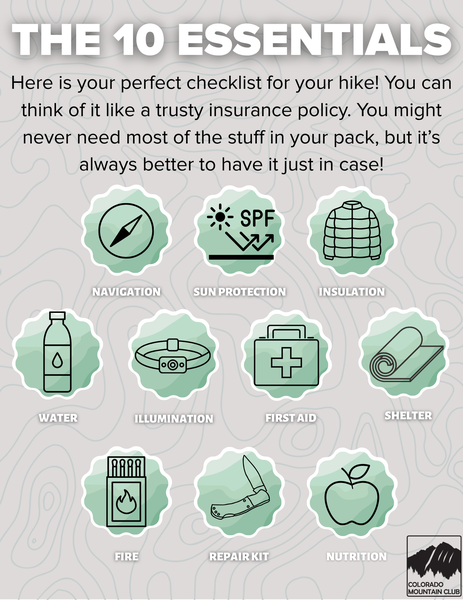
Route-specific gear: helmet (mandatory from the ridge onward), sturdy boots with good edging, trekking poles, layers for cold and wind, sun protection, headlamp for the dark start, ample water (the upper route is dry), navigation with the 14ers GPX downloaded offline, and the 10 essentials.
Known hazards: afternoon thunderstorms on exposed terrain, loose scree and talus throughout, rockfall, route finding errors on the northeast ridge, and the tempting but dangerous direct descent slope from the 13,790' saddle. When that slope is snow free it is a serious hazard, so the safe descent is to reclimb Castle and return via the standard northeast ridge.
Unusual Conditions / Technical Skills / What Participants Need to Know
Montezuma Basin sits high, shaded, and north facing, so it holds snow longer than most Colorado basins. By early August the route is often mostly dry, but this varies year to year, so conditions must be checked in the days before the trip.
If the headwall above the road end or the direct saddle descent slope still hold firm snow on August 1, participants will need an ice axe and microspikes plus the skill to self arrest. If everything is dry, snow gear can be left behind. Leaders should make this an explicit go/no go gear call based on the 14ers.com condition reports shortly before the trip.
Other essentials for participants to know: this is a long, committing day with considerable exposure and loose rock, an alpine start in the dark is required, helmets are mandatory on the upper mountain, the high 4WD road is impassable for most vehicles so plan to walk the lower road, and the trip enters designated wilderness with group size li
For questions about your trip, please reach out to your trip leader directly. For general questions about the Summit 2026 project or any relate event, please reach out to summit2026@cmc.org.
This is an alpine start with a long approach, so the plan is built around camping near the trailhead the night before (Friday, July 31) rather than driving up from town in the dark.
Where to camp: Drive yourself to the Castle Creek (lower / 2WD) trailhead and camp at a dispersed site along the lower road. Sites are first come, first served, so arrive Friday evening to claim a spot.
Trailhead coordinates: 39.0292, -106.8078 (39°01'45"N, 106°48'28"W), elevation about 9,800', roughly 12.5 paved miles up Castle Creek Road from the Aspen roundabout.
Summit-day gather: Meet at the Castle Creek trailhead, fully geared up and ready to step off, at 3:45 am Saturday, August 1. This is a ready-to-walk time, not an arrival time, so eat, fill water, and sort your pack before then. We start walking at 4:00 am sharp to beat afternoon weather. If you choose to drive up that morning instead of camping, build in the full drive from town plus buffer and plan to be at the trailhead and packed by 3:30 am.
Parking, vehicle, and road notes: Park at the lower trailhead unless you have a capable high clearance 4WD and are comfortable on a rough rocky road and the creek crossing at 10,200'. Most vehicles should not attempt above the creek crossing, and the upper road to 12,800' is impassable for stock SUVs. The route enters designated wilderness higher up, so follow group size limits and Leave No Trace rules.
Required Equipment
This Class 3, helmets are required.