Trip
Summit 2026 – Pikes Peak via Crags Campground
A special commemoration of 250/150 on Colorado Day to summit the state's 14ers. This trip is intended for members of Achilles Pikes Peak, a group that pairs athletes with disabilities with volunteer guides.
Contacts

- Sat, Aug 1, 2026
- Summit 2026
- Hiking
- Adults
- Challenging
- Mileage: 14.0 mi
- Elevation Gain: 4,400 ft
- 3 (8 capacity)
- FULL (2 capacity)
- Cancellation & Refund Policy
This trip is intended for members of Achilles Pikes Peak (athletes with disabilities and qualified guides).
All participants and leaders are REQUIRED to sign the State of Colorado's liability waiver. Please click here to fill out the waiver.
Route description from 14ers.com: Leave the trailhead, cross Fourmile Creek on a wooden bridge, and begin ascending the trail After half a mile, pass a junction where a spur from the Crags Campground intersects with the Crags trail. Walk another 30 yards to reach a second junction and turn right onto the Devil's Playground trail. Cross a stream on a log bridge and follow the well-defined trail. At 10,400', cross another stream. Continue heading east for approximately one mile until you reach a small clearing near 11,000'. At 11,050 feet, the trail swings left and begins ascending a long, rugged section to reach a corner at 11,400'. Stay right as the trail zigzags up the steep hillside and exits the trees near 11,900'. Follow the trail eastward up a slope.
At the top of the slope, at 12,750 feet, the summit comes into view. Continue heading east along the broad trail, passing through a strip of rocks to arrive at the Devil's Playground area. Cross to the east side of the Pikes Peak road and follow the marked trail. You are still over 2 miles away from the summit. Continue southward around a point, descend slightly, and pass a corner of the road at 12,900'. Near 13,150 feet, reach an overlook on the left side of 13er point "Little Pikes Peak," where the remaining route becomes visible. Continue to another road corner and ascend to a flat area below the final pitch.
Above 13,600' lies the crux of the route: approximately 350 feet of easy Class 2 rock-hopping. The route is well-cairned, and the rock is mostly stable. Take your time and zigzag higher. At the top of the ridge, walk past another corner of the road and proceed to the summit.
Trip leaders- Do not delete: Participants can register for their preferred 14er through the Colorado Mountain Club website, where they will be placed on a waitlist for their chosen peak. From there, trip leaders will reach out to gather more information about each participant's experience level and interests. For trips where the waitlist exceeds the allotted group size, participants will be selected by lottery.
For questions about your trip, please reach out to your trip leader directly. For general questions about the Summit 2026 project or any relate event, please reach out to summit2026@cmc.org.
We will meet at the Crags Trailhead at 6:00 am and begin the hike promptly at 6:15 am. An optional carpool/caravan will meet at Safeway in Colorado Springs (3275 W Colorado Avenue) and depart at 5:00 am. Additionally, there is optional overnight paid camping available at the Crags Campground.
Directions to Crags Trailhead: Take U.S. 24 to Divide. Turn south onto Colorado 67 and drive 4.3 miles. Turn left onto County Road 62 (turns into Forest Service 383) and drive 3.0 miles to the trailhead. If you're camping at the Crags Campground, continue 0.1 mile farther up the road and turn left into the campground. At the far end of the campground there is access to the trail.
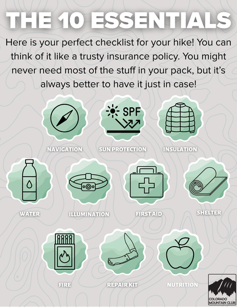
Required Equipment