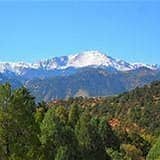
Pikes Peak via Crags Campground
This is the shorter route up Pikes Peak and can be done in one day.
This side of Pikes Peak (14,109') is a popular area for backpacking, camping, and hiking. See details, gpx tracks, and maps at 14ers.com - 14 miles, 4300' gain - Class 2
TH located at Crags Campground. Note seasonal road closure: Forest Road #383 leading to Crag's Trailhead is subject to a seasonal closure from December 1 to June 1. For more information, visit https://www.fs.usda.gov/r02/psicc/recreation/crags-trailhead-664
- Suitable Activities: Hiking
- Seasons: May, June, July, August, September, October, November
- Weather: View weather forecast
- View avalanche forecast.
- Difficulty: Challenging
- Length: 14.0 mi
- Elevation Gain: 4,400 ft
- 14,109 ft
-
Land Manager:
U.S. Forest Service
Pikes Peak Ranger District (PSINF)
- Parking Permit Required: USFS Permits & Passes
- Recommended Party Size: 12
- Maximum Party Size: 12
- Maximum Route/Place Capacity: 12
Upcoming Activities
Past Activities
Map
Divide, CO 80814
- 14ers.com
- AllTrails
- CoTrex
- SummitPost
Trip Reports
Resources
There are no resources for this route/place. Log in and send us updates, images, or resources.