Trip
Summit 2026 – Torrey's Peak
A special commemoration of 250/150 on Colorado Day to summit the state's 14ers.
Contacts

- Sat, Aug 1, 2026
- Summit 2026
- Hiking
- Adults
- Moderate
- Mileage: 7.75 mi
- Elevation Gain: 2,992 ft
- 5 (9 capacity)
- 1 (3 capacity)
- Cancellation & Refund Policy
All participants and leaders are REQUIRED to sign the State of Colorado's liability waiver. Please click here to fill out the waiver.
All participants with Latino Outdoors also need to fill out this attached waiver.
This trip has priority for invited guests of Latino Outdoors and Outdoor Unidos. You can learn more about each of the organization their profile. If you are interested in joining this trip, you can request leader permission to be added to a standby list in case of availability or cancelations.
Route Information:
Driving there:
Take I-70 to the Bakerville exit (#221). Leave the highway and drive south over to the dirt parking area near the start of Forest Road 189. This is the winter trailhead and even if the upper road is open, low-clearance passenger cars should park here. It's almost 3 miles to the summer trailhead. Continue up the Grays Peak (189) road. After 1 mile, stay straight at a junction. Continue another 2 miles to the trailhead, at 11,280'. There are restrooms and a few dispersed camping spots near the parking area.
Trailhead:
From the trailhead, cross the large bridge spanning the stream in Stevens Gulch. Continue into the basin for approximately 1.5 miles to reach an information sign, about halfway into the hike. From there, hike up to and across a rocky area near 12,300' . Follow the trail as it winds around a small ridge that runs south toward the east side of Grays. Above 12,600', the trail swings left, traversing along the west side of the rocky ridge. Continue upward to reach the Grays-Torreys trail junction at 13,300'
Depart from the Grays trail and traverse southwest to reach the Grays-Torreys saddle, above 13,700'. Please remain on the trail for the entirety of this section to minimize environmental impact. From the saddle, turn right and follow the Torreys trail for the final 1/2 mile ascent to the summit.
For more information about the route/trailhead see here.
For general questions about the Summit 2026 project or any relate event, please reach out to summit2026@cmc.org.
Due to limited parking capacity, we will encourage carpooling and may coordinate a meeting point at the Mammoth Parking Lot. Additional details will be discussed with the full team at a later date.

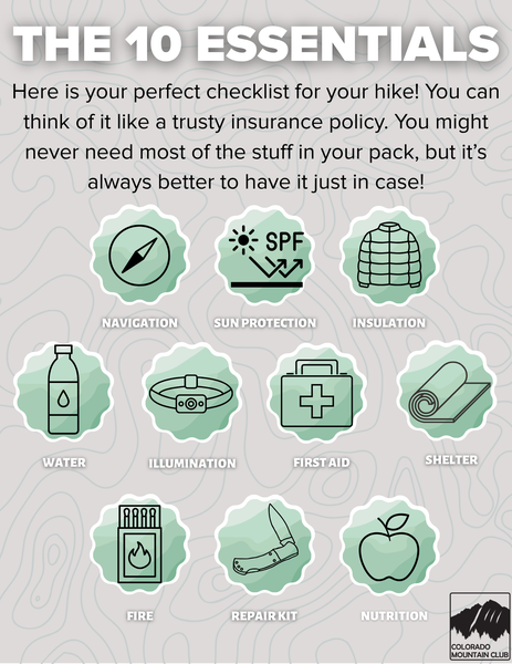
Required Equipment