BPX 2-Day: Colorado Trail - Collegiate West 02 from the Cottonwood Pass TH
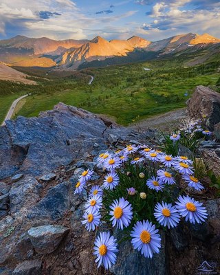
This 2 day out-and-back backpacking trip follows Collegiate West 02 (CW02) north from Cottonwood Pass along the South Texas Trail into the glacial valley of Texas Creek. It offers a high-alpine start, sweeping views of the Continental Divide and Sawatch Range, and peaceful forest camping below tree line.
Suggested Backpacking Section (BPX) itinerary for 2-day trip to be used for CMC trips led by BPX leaders for BPX members.
Day 1: Begin at the paved summit of Cottonwood Pass (12,126 ft) and hike north on the Collegiate West 02/South Texas Trail (#417). The trail starts above tree line, crossing alpine tundra with expansive views of the Sawatch Range and Taylor Park. Soon you will begin a steady descent into the South Texas Creek basin. As you drop below tree line (~11,600 ft), the path enters subalpine pine and aspen forests. Set up camp at established, water-adjacent campsites along South Texas Creek (4.3 miles, +233 / -2,080 ft.). Eat lunch and if weather looks favorable, day hike further north along the Colorado Trail to approximately Waterloo Gulch (3.9 miles +-352 ft.).
Optional Day Hike: Waterloo Gulch (3.75 miles, +-320 ft.)
Day 2: Break camp and hike back South along the Colorado Trail to Cottonwood Pass TH (4.3 miles, +2,080 / -233 ft.).
Overall Route: 8.7 miles, +-2,308 ft.
NOTES:
- Always practice Leave No Trace techniques.
- More information about the Colorado Trail is available here.
- Driving Directions: From the Colorado Mountain Club (Golden, CO) to the Cottenwood Pass TH.
- Suitable Activities: Backpacking
- Seasons: June, July, August, September
- Weather: View weather forecast
- Length: 8.7 mi
- Elevation Gain: 2,308 ft
- 12,223 ft
-
Land Manager:
U.S. Forest Service
Collegiate Peaks Wilderness Area, Salida Ranger District (PSINF)
- Parking Permit Required: USFS Permits & Passes
- Recommended Party Size: 6
- Maximum Party Size: 12
- Maximum Route/Place Capacity: 12
- Trails Illustrated 129
There are no resources for this route/place. Log in and send us updates, images, or resources.