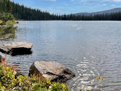
Crater Lakes
The beautiful Crater Lakes provide an opportunity to enjoy some of the best views of the James Peak Wilderness. Suitable for day hiking, snowshoeing or a short backpacking trip. The full distance including hike to the upper lake is 7.4 roundtrip with 1,870 elevation gain. The final hike to the upper lake requires scrambling.
The trip starts at the East Portal Trailhead located at the end of Gilpin County Rd 16. Follow the Boulder Creek Trail (#900) to the junction with the Crater Lakes Trail (#819) and follow that trail north about one mile to the lakes. The first two miles are a gradual climb but the terrain gets steeper.
Many hikers stop after reaching and enjoying the two lower Crater Lakes. But you can continue the hike on-trail from the northwest corner of the western, largest lake on an obvious (but unmaintained) extension of the Crater Lakes Trail to a further, upper alpine lake, sometimes called the third Crater Lake. This will pass a few campsites. That trail ascends steeply along the upper lake outlet stream valley and there are a couple of beautiful waterfalls. This trail leads directly to the upper lake.
- Suitable Activities: Backpacking, Hiking, Scrambling, Snowshoeing
- Snowshoeing Category: Intermediate
- Seasons: Year-round
- Weather: View weather forecast
- Length: 7.4 mi
- Elevation Gain: 1,870 ft
- 11,127 ft
-
Land Manager:
U.S. Forest Service
James Peak Wilderness Area, Boulder Ranger District (ARNF)
- Parking Permit Required: USFS Permits & Passes
- Recommended Party Size: 12
- Maximum Party Size: 12
- Maximum Route/Place Capacity: 12
- caltopo
- https://caltopo.com/map.html#ll=39.90822,-105.66736&z=14&b=mbt&a=c
This is a list of titles that represent the variations of trips you can take at this route/place. This includes side trips, extensions and peak combinations. Not seeing a title that fits your trip? Log in and send us updates, images, or resources.
- Crater Arapahoe Lakes Lariat
There are no resources for this route/place. Log in and send us updates, images, or resources.