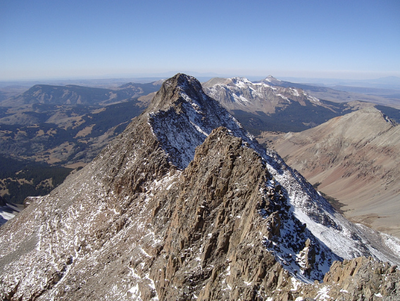
El Diente Peak
A 14'er in the San Miguel Mountains, near the Town of Rico in Dolores County.
El Diente Peak (14,165') is a high summit located in the Lizard Head Wilderness of the San Juan National Forest. "El Diente" is Spanish for "The Tooth", a reference to the shape of the peak. Often climbed in combination with Mt Wilson, and sometime adding Wilson Peak.
The Wilderness is managed jointly by USFS Norwood Ranger District and Dolores Ranger District.
Find details and GPX tracks at 14ers.com - https://www.14ers.com/peaks/10064/el-diente-peak?t=photos
--From Navajo Lake - 9.5 miles, 2000' - Class 1
--From Upper Navajo Basin - 13 miles, 3700' - Class 1
Rock of Ages Approach - 8.5 miles, 2800' - Class 1
Kilpacker Approach - From the Kilpacker Basin TH:
--If camping in the basin - 6 miles RT, 800' gain - Class 1
--If starting at the TH - 10.50 miles RT to the El Diente off-trail turn-off, 800' gain - Class 1
Woods Lake Approach - 9 miles, 2115' gain - Class 1
South Slopes - 12 miles, 4400' gain - Class 3
North Slopes - 15 miles, 5000' gain - Class 3
North Buttress - 5 miles, 3200' gain - Class 4
- Suitable Activities: Hiking, Mountaineering
- Seasons: May, June, July, August, September, October
- Weather: View weather forecast
- View avalanche forecast.
- 14,165 ft
-
Land Manager:
U.S. Forest Service
Lizard Head Wilderness Area, Norwood Ranger District (GMUG)
- Parking Permit Required: USFS Permits & Passes
- Recommended Party Size: 6
- Maximum Party Size: 12
- Maximum Route/Place Capacity: 12
- 14ers.com
- CoTrex
- AllTrails
- AllTrails
This is a list of titles that represent the variations of trips you can take at this route/place. This includes side trips, extensions and peak combinations. Not seeing a title that fits your trip? Log in and send us updates, images, or resources.
- El Diente - Navajo Lake Approach
- El Diente - Rock of Ages Approach
- El Diente - Kilpacker Approach
- El Diente - Woods Lake
- El Diente - South Slopes
- El Diente - North Slopes
- El Diente - North Buttress
There are no resources for this route/place. Log in and send us updates, images, or resources.