Colorado's trails are a lifeline for outdoor enthusiasts, offering unparalleled access to stunning landscapes and invigorating recreation. But maintaining this vast network of trails is a monumental task, one that relies heavily on the dedication of land managers and volunteers. This summer, with significant staffing cuts impacting land management agencies, that task will become even more challenging. That's where Colorado Mountain Club's Recreation Impact Monitoring System (RIMS) app steps in – putting the power of trail stewardship directly into your hands.
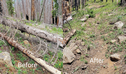
Imagine this: you're out on your favorite hike when you encounter a section of trail with significant erosion, a downed tree blocking the path, or a campsite littered with trash. In the past, you might have felt a pang of concern, perhaps even considered reporting it later, but without a clear, efficient way to do so, it might have slipped your mind. The RIMS app changes that.

RIMS: Your Mobile Trail Reporting Tool
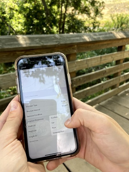
The RIMS app transforms your outdoor adventures into powerful acts of citizen science. It's a free and easy-to-use mobile application for both Android and Apple devices that allows you to collect crucial data on the condition of our public lands, right from the trail.
The beauty of RIMS lies in its simplicity and comprehensive features. While you're enjoying your activity, you can:
- Geo-locate issues with precision: The app uses your phone's GPS to pinpoint the exact location of any problem you observe, whether it's a damaged trail, an impacted campsite, or an overflowing trailhead. No more trying to describe "that big rock near the third switchback"!
- Document with photos: Snap pictures of the issue to provide visual context for land managers. A picture truly is worth a thousand words when it comes to understanding the scope of a problem.
- Provide detailed assessments: RIMS offers structured surveys and objective metrics for various issues. You can report on:
- Trail conditions: Is there erosion? Are there fallen trees, washouts, or muddy sections? You can rate the severity (excellent, fair, poor, extremely poor) to highlight urgent needs.
- Campsite impacts: Report on ground disturbance, fire ring conditions, proximity to water sources, and presence of litter.
- Signs and facilities: Is a sign vandalized or missing? Is a restroom facility in disrepair?
- Visitor use: Help land managers understand patterns of use by logging observations of other visitors, vehicles at trailheads, and even potential user conflicts.
- Work offline: Even if you lose cell service deep in the backcountry, RIMS allows you to save your assessments and sync them later when you're back in range. This is incredibly valuable for truly remote areas.

Using RIMS allows you to contribute data for land managers. All the data you collect paints a comprehensive picture for land managers. This data is accessible through dashboards and mapping platforms, allowing agencies to:
- Prioritize hot spots: Identify areas with the most significant or urgent issues.
- Deploy crews efficiently: Know exactly where to send their limited resources for maximum impact.
- Track trends: Understand how recreation impacts are changing over time.
- Inform planning and grant writing: Use concrete data to advocate for resources and develop effective management strategies.
Why RIMS is More Important Than Ever This Summer
Recent and ongoing staffing cuts within land management agencies mean fewer stewardship crews to maintain trails, manage campgrounds, and fix minor problems before they become major issues. This could lead to a decline in trail conditions, safety concerns, and a diminished outdoor experience for everyone.
The RIMS app offers a powerful solution to this problem. By using RIMS, you become an invaluable extension of our land management teams. You become their eyes and ears in the backcountry, providing them with real-time, geo-located information that they simply don't have the staffing to collect themselves.
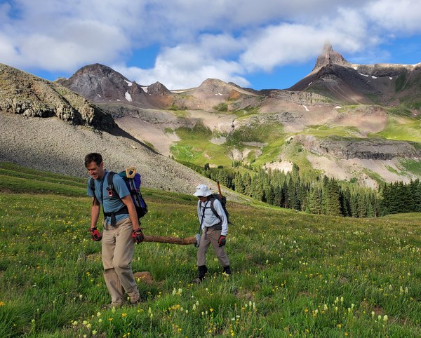
Think of it as a community effort. While you're enjoying a hike, mountain bike ride, or camping trip, you're simultaneously helping to protect and preserve the very places you love. It's a seamless way to contribute to conservation without adding extra commitments to your already busy life.

Be a Part of the Solution
Downloading and using the CMC RIMS app is a simple yet impactful way to help ensure the beauty and accessibility of Colorado's public lands for generations to come. It’s an opportunity to take ownership of our shared outdoor spaces and directly support the tireless efforts of land managers.
So, before your next adventure, watch the training video and download the CMC RIMS app. Take a few minutes to familiarize yourself with its features. And as you explore, keep an eye out for areas that need attention. Your small act of reporting can make a significant difference, helping land managers know exactly where to send their crews and ensuring our trails remain safe, sustainable, and enjoyable for all.
 Felicia Brower

Add a comment
Log in to add comments.Thanks for the reminder; I just downloaded the app and will begin using it, now that I'm back to hiking again. Great cooperative effort with the land management organizations ... I appreciate whoever put in the time on this (and there had to be a lot of it spent).