Trip
Ascending Hikes – Matthews/Winters Park
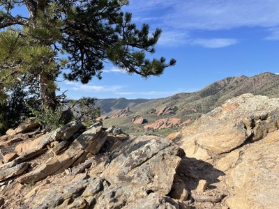
Let's explore the series of easy, moderate and challenging trail segments as we go on a circuit hike through Matthews/Winters Park. Panoramic views and access to Dinosaur Ridge and the Red Rocks area for distinct paleontology and geology.
- Tue, May 9, 2023
- Ascending Hikes Section
- Hiking
- Adults
- Challenging
- For Beginners (Getting Started Series)
- Mileage: 6.55 mi
- Elevation Gain: 737 ft
- High Point Elevation: 6,744 ft
- Maximum Wind: 10 kts
- Pace: 2.0 mph
- 5 (10 capacity)
- 1 (2 capacity)
- Cancellation & Refund Policy
We'll hike these trail segments: Parking lot connector trail (0.1 mile) => Dakota Ridge Trail (2.1 miles) => Alameda Parkway Crossing => Dakota Ridge Trail (2.2 miles) => Bailout Trail (0.4 mile) => Red Rocks Trail (0.9 mile) => W. Alameda Parkway Crossing => Red Rocks Trail (1.0 mile) => Morrison Slide Trail (1.4 mile) => Cherry Gulch Trail (0.3 mile) => Red Rocks Trail (1.1 mile) => Village Walk Trail (0.4 mile) => Connector Trail (0.1 mile) = 10 miles. This hike has several bailout points and easier trail segments to remain mindful of those in the process of developing their strength, stamina, speed and endurance. Matthews Winters Trailhead | COTREX (colorado.gov)
Matthews/Winters Park Trailhead, 1103 County Highway 93, Golden, CO - Let's meet at 7:00am, conduct a brief trailhead orientation, and begin our hike by 7:15am.
Matthews/Winters Park
-
https://www.jeffco.us/DocumentCenter/View/9376/MatthewsWinters-Park-Map?bid==3DId=3D3D - See full route/place details.
