Trip
Hiking – Mount Sherman - The West Slopes Route
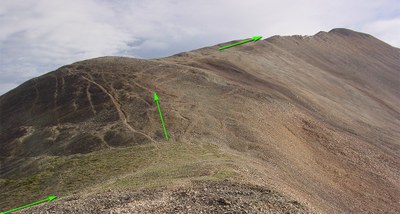
This is part of the RMOTHG Turquoise Lake campout. We will meet in the Baby Doe campground. Additional information will be provided at dinner. We will take the West Slope route to the summit. Our trailhead is 12,000', Iowa Gulch Trailhead Start 12,000 feet, Summit 14,043 feet, Total Gain 2,150 feet RT Length 4.5 miles
- Wed, Aug 6, 2025
- Rocky Mountain Over the Hill Gang
- Hiking
- Adults
- Difficult
- Mileage: 4.5 mi
- Elevation Gain: 2,150 ft
- High Point Elevation: 14,043 ft
- Pace: 1.5 mph
- 6 (6 capacity)
- 1 (2 capacity)
- Cancellation & Refund Policy
Sign up for this hike if you've hiked at 10,000' in the past 10 days - due to starting at 12,000'. Starting at 8 am, our plan is to be headed down before 11:00 am. Slow, Steady, minimal stops. All high-altitude & above-treeline peak climbs are serious undertakings. We have to come prepared for any and all weather & terrain conditions. (Anyone else learn this the hard way?! :)
We'll leave the campground at 7:15 am for at 8:00 am trailhead start time.
Directions from:
Baby Doe Campground:
Iowa Gulch Trailhead (Leadville, CO 80461)
Mount Sherman
-
https://caltopo.com/map.html#ll=3D3D3D3D39.22313,-106.16942&z=3D3D3D3D14&b==3D3D3D=3D3Dmbt&=3D3Da=3D3D3D3Dst=3D3D3Dructures - See full route/place details.
Required Equipment
Bring your 10 essentials, lunch and plenty of water. Sturdy trail shoes a must.
