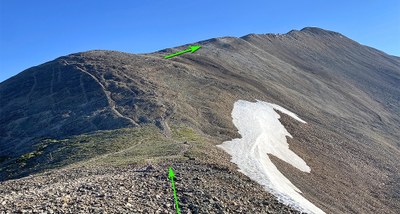
Mount Sherman
Located in the Mosquito Ranch near Fairplay, Mount Sherman has a reputation as one of the easiest 14ers to climb. Highlights include stunning 360 degree views of surrounding 13,000 and 14,000 foot peaks, some amazing historic mining structures along the way, and the possibility of seeing mountain goats and moose.
Routes vary from easier to more challenging. The last 1/2 mile to the summit traverses a ridge with steep drop-offs on either side – but the wide path is never too difficult or technical. You are rewarded with stunning 360 degree views of surrounding 13,000 and 14,000 foot peaks – including the highest Colorado 14er, Mount Elbert as well as Mount Massive.
Alternate titles -
The Southwest Ridge Route: 5 miles, 2100 ft elevation gain
The West Slopes Route: 4.5 miles, 2150 ft elevation gain
The South Slope Route: 8.5 miles, 3100 ft elevation gain
- Suitable Activities: Hiking
- Seasons: Year-round
- Weather: View weather forecast
- Difficulty: Moderate
- Length: 5.0 mi
- 14,043 ft
-
Land Manager:
U.S. Forest Service
South Park Ranger District (PSINF)
- Parking Permit Required: USFS Permits & Passes
- Recommended Party Size: 12
- Maximum Party Size: 12
- Maximum Route/Place Capacity: 12
- https://caltopo.com/map.html#ll=3D3D3D3D39.22313,-106.16942&z=3D3D3D3D14&b==3D3D3D=3D3Dmbt&=3D3Da=3D3D3D3Dst=3D3D3Dructures
This is a list of titles that represent the variations of trips you can take at this route/place. This includes side trips, extensions and peak combinations. Not seeing a title that fits your trip? Log in and send us updates, images, or resources.
- Mount Sherman - The Southwest Ridge Route
- Mount Sherman - The West Slopes Route
- Mount Sherman - The South Slope Route
There are no resources for this route/place. Log in and send us updates, images, or resources.
