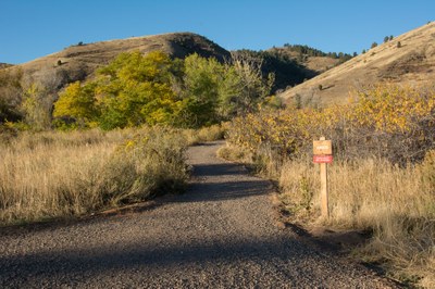
Apex Park
• Even Calendar Dates (2nd, 4th, etc.) = Bikes only, no hikers or equestrians • Odd Calendar Dates (1st, 3rd, etc.) = Hikers and equestrians only, no bikes
-
All users of Jeffco parks (both free trips and paid for courses) must carry with them a copy of the CMC-Jeffco Permit or a yellow permit tag
-
The permit can be found at this link
-
Permit tags can be picked up at the CMC Basecamp office (T-Th 10am-6pm)
-
ONLY ONE GROUP may use a trail system at a time. Group size is limited to 14 participants, including guides/instructors.
-
A trail system includes that entire area of that park - ie, if a group begins a hike on the east side of North Table, another group may not hold another hike on the west side of North Table.
-
Blackout dates - No CMC trips may take place on the following dates:
- Memorial Day Weekend - May 24-26; Father’s Day – June 15; Juneteenth – June 19; Independence Day Weekend – July 4-6; Labor Day Weekend – Aug 30-Sept 1
For further information and any restrictions see: Apex Park | Jefferson County, CO (jeffco.us)
Directions to parking lot: Apex Trailhead - Google Maps
Alternate title data:
Apex and Enchanted Forest Trail Loop - 5.5 miles - 1243 ft elevation gain
Apex and Pick N' Sledge Trail - 6.7 miles - 1473 ft elevation gain
Pick N Sledge and Grubstake Loop Trail - 5.0 miles - 1197 ft elevation gain
Apex and Pick N Sledge Loop - 3.9miles - 997 ft elevation gain
Apex Open Space Complete Loop Trail - 8.8 miles - 2007 ft elevation gain
Windy Saddle Park/Apex Park Connector Trail - 7 miles one way - 700 ft elevation gain
To review the Trip Leader Checklist see: Shared R:P+Trip Leader Activity Checklists - Google Docs
- Suitable Activities: Biking, Hiking, Snowshoeing
- Seasons: Year-round
- Weather: View weather forecast
- 7,280 ft
- Land Manager: Jefferson County Open Space
- Parking Permit Required: Other
- Recommended Party Size: 12
- Maximum Party Size: 14
- Maximum Route/Place Capacity: 14
This is a list of titles that represent the variations of trips you can take at this route/place. This includes side trips, extensions and peak combinations. Not seeing a title that fits your trip? Log in and send us updates, images, or resources.
- Apex Trailhead - Apex and Enchanted Forest Trail Loop
- Apex Trailhead - Apex and Pick N' Sledge Trail
- Apex Trailhead - Pick N Sledge and Grubstake Loop Trail
- Apex Trailhead - Apex and Pick N Sledge Loop
- Apex Trailhead - Apex Open Space Complete Loop Trail
- Apex Trailhead - Windy Saddle Park/Apex Park Connector Trail
There are no resources for this route/place. Log in and send us updates, images, or resources.
