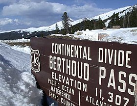
Berthoud Pass
Berthoud Pass is a high mountain pass in central Colorado, in the Rocky Mountains of the western United States. Located about an hour outside of Denver (depending on traffic).
Alternate title:
Second Creek Trailhead - 2 miles, 1339 ft elevation gain
Take I-70 to US highway 40 over Berthoud Pass, on the west side of the road is mile marker 240. The TH is 39.82273, -105.76979. At the TH, the forest is dense with pine trees, the trail begins with a steep climb then bends to the left and becomes a more gradual climb.
Second Creek Trailhead to Twin Cones - 5.3 miles, 1466 ft elevation gain
Continue on the trail to see the Continental Divide and reach Twin Cones. Be prepared for wind above tree line.
https://www.alltrails.com/trail/us/colorado/second-creek-trail-to-twin-cones?search=true
Second Creek Trailhead to Broome Hut - 1 miles, 900 feet elevation gain
There is a "day room" for your convenience and a bathroom inside the day room which is entered on the east side of the hut .
https://www.huts.org/The_Huts/broomeHut.php
Fraser River: 5 miles, 1600 ft elevation gain
Starting from the last switchback on US 40 on the Winter Park side of Berthoud Pass, this off-trail hike travels south along the Fraser River through a quiet winter landscape. The route passes through open meadows and forested areas, offering close views of the river and a feeling of solitude away from the road. The halfway point of the hike is the Berthoud Pass warming, providing the opportunity to have a warm place to eat, before venturing out, returning to the starting point along the same route.
- Suitable Activities: Hiking, Snowshoeing
- Snowshoeing Category: Basic
- Seasons: Year-round
- Weather: View weather forecast
- Avalanche Terrain Rating Challenging View avalanche forecast.
-
Land Manager:
U.S. Forest Service
Clear Creek Ranger District (ARNF)
- Parking Permit Required: USFS Permits & Passes
- Recommended Party Size: 12
- Maximum Party Size: 18
- Maximum Route/Place Capacity: 18
This is a list of titles that represent the variations of trips you can take at this route/place. This includes side trips, extensions and peak combinations. Not seeing a title that fits your trip? Log in and send us updates, images, or resources.
- Berthoud Pass - Second Creek TH
- Berthoud Pass - Second Creek TH to Broome Hut
- Berthoud Pass - Second Creek TH to Twin Cones
- Berthoud Pass - Fraser River
There are no resources for this route/place. Log in and send us updates, images, or resources.
