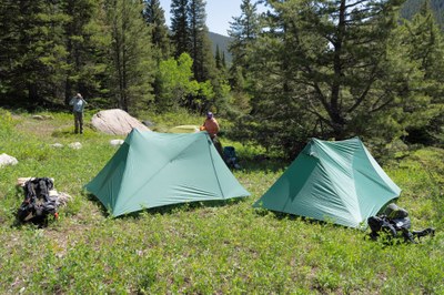
BPX 2-Day: James Peak Wilderness from East Portal TH
This is an out and back, easy early season and close-in trip. From the Moffat Tunnel East Portal TH along the South Boulder Creek Trail into the James Peak Wilderness. Campsite is along the Arapaho Creek. Intended for use as pre-season gear shakedown trip for those wanting to test their personal fitness and backpacking equipment, before hitting the long trails. Total distance ~ 2 miles and 300 feet elevation gain.
This 2-day, 1-night backpacking trip into the James Peak Wilderness begins at the Moffat Tunnel East Portal TH. Hikers will follow the South Boulder Creek Trail, navigating through diverse terrain, before reaching a scenic campsite near Arapaho Creek for an overnight stay. The route offers stunning views of the surrounding peaks and an immersive wilderness experience, ideal for a gear check and brief escape into nature, with optional day hikes to Forest Lakes, Crater Lakes, or Heart Lake to further explore the area.
Suggested Backpacking Section (BPX) itinerary for 2-day trip to be used for CMC trips led by BPX leaders for BPX members.
Day 1: Starting at the East Portal TH hike ~1 mile into the James Peak Wilderness along the South Boulder Creek Trail (#900) to the west side of the Arapaho Creek crossing and head off-trail to the northwest to locate the campsite (~1 mile, +268 / -40 ft.).
Day 2: Hike out same path (~1 mile, +40 / -268 ft.).
Overall Route: ~2 miles, +--310 ft.
NOTES:
- Always practice Leave No Trace principles.
- More information about the James Peak Wilderness is available here.
-
Optional Day hikes:
1. Forest Lakes : 6.1 miles, +-1,685 ft.
2. Crater Lakes: 4.4 miles, +-1,295 ft.
3. Heart Lake: 7.2 miles, +-2,059 ft.
- Driving Directions: From the Colorado Mountain Club (Golden, CO) to the East Portal TH.
- Suitable Activities: Backpacking
- Seasons: June, July, August, September, October
- Weather: View weather forecast
- Difficulty: Easy
- Length: 2.0 mi
- Elevation Gain: 300 ft
- 9,468 ft
-
Land Manager:
U.S. Forest Service
James Peak Wilderness Area, Boulder Ranger District (ARNF)
- Parking Permit Required: USFS Permits & Passes
- Recommended Party Size: 6
- Maximum Party Size: 12
- Maximum Route/Place Capacity: 12
- Trail Illustrated 103
- COTREX
- CalTopo
There are no resources for this route/place. Log in and send us updates, images, or resources.
