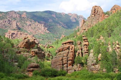
BPX 4-Day: Lost Creek from Lost Park TH
This 13-mile out-and-back backpacking trip through Colorado’s Lost Creek Wilderness offers a scenic and rugged adventure into the heart of the wilderness.
Suggested Backpacking Section (BPX) itinerary for 4-day trip to be used for CMC trips led by BPX leaders for BPX members.
Starting Point: Lost Park Campground/TH, located at the end of Lost Park Road (County Road 56) near Jefferson, CO. The campground offers 12 campsites at an elevation of 10,000 feet, with basic amenities like toilets, tables, and fire rings.
Day 1: Follow the Wigwam Trail (#609) south and east paralleling Lost Creek for about 3.1 miles, then follow the creek on social trails as it turns south (and away from the Wigwam) and passes a long set of cascades. Where the creek passes under a boulder field the route crosses the creek, then later crosses again via a cairned route over even larger house-size boulders. Continuing up a slope and over a minor ridge, the route drops back down to the creek and runs into the McCurdy Park Trail (#628), the turnaround point. Along the way there is occasional class 2 scrambling (6.4 miles, +237 / -1,234 ft.).
Day 2 & 3: Take exploratory day hikes to various destinations in the area, fish in the nearby streams, or relax at camp.
Day 4: Return to the Lost Park TH via the route you followed on Day 1 (6.4 miles, +1,234 / -237 ft.)
Overall Route: 13.8 miles, +-1,471 ft.
NOTES:
- Always practice Leave No Trace techniques.
- More information about Lost Creek Wilderness is available here.
- Navigation: The social trails along Lost Creek are not maintained and can be difficult to follow. It's advisable to use a GPS device or a detailed map to assist with navigation.
- CalTopo Map/Route
- Water Crossings: Be prepared to cross Lost Creek multiple times. Depending on water levels, these crossings can be challenging, so exercise caution and consider water levels before attempting.
- Camping: Camp only in designated or durable areas to minimize your impact on the wilderness.
- Permits: A permit is required to enter the Lost Creek Wilderness. Ensure you obtain the necessary permits before your trip.
- Google Map Driving Directions: From the Colorado Mountain Club (Golden, CO) to the Lost Park Campground/TH.
- Suitable Activities: Backpacking
- Seasons: June, July, August, September, October
- Weather: View weather forecast
- Difficulty: Moderate
- Length: 12.8 mi
- Elevation Gain: 1,471 ft
- 9,931 ft
-
Land Manager:
U.S. Forest Service
Lost Creek Wilderness Area, South Park Ranger District (PSINF)
- Parking Permit Required: USFS Permits & Passes
- Recommended Party Size: 6
- Maximum Party Size: 12
- Maximum Route/Place Capacity: 12
- Trails Illustrated 105
There are no resources for this route/place. Log in and send us updates, images, or resources.
