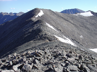
Clinton Peak
A Class 2 hike to the 81st highest peak in Colorado, located SW of Quandary Peak and NW of Mt Lincoln, along the Continental Divide.
Named after President Bill Clinton, Clinton Peak (13,866') is part of the Mosquito Range, and is accessed between Breckenridge and Alma. Start at the Montgomery Reservoir TH, off CO-9, south of Hoosier Pass. 14ers.com has an detailed South Slope route description with GPX, map and photos, plus detailed directions to the TH.
14ers.com and AllTrails suggest a possible combination with Traver Peak and McNamee Peak.
- Suitable Activities: Hiking, Scrambling
- Seasons: May, June, July, August, September
- Weather: View weather forecast
- View avalanche forecast.
- Length: 9.0 mi
- Elevation Gain: 2,900 ft
- 13,866 ft
-
Land Manager:
U.S. Forest Service
Dillon Ranger District (WRNF)
- Parking Permit Required: USFS Permits & Passes
- Recommended Party Size: 12
- Maximum Party Size: 12
- Maximum Route/Place Capacity: 12
- 14ers.com
- climb13ers.com
- CoTrex
- AllTrails
- AllTrails
There are no resources for this route/place. Log in and send us updates, images, or resources.
