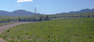
Coalton Trailhead
Once the nation's smallest wildlife refuge, the Coalton Trailhead is on the west side of the intersection of McCaslin Road and Coalton Road in Superior. It is the start point for two trails that run through an open, rolling prairie hills in an ecosystem of sun-exposed grassland with broad views of the front range foothills to the west, and rolling land extending to the east.
Trails Commencing at Coalton Trailhead
Coalton Trail is a moderately easy out-and-back, relatively on-the-flat in rolling prairie land. The trail begins as a broad multi-use unpaved trail which diminishes to singletrack, from which one can enjoy vistas of the Flatirons and mountains behind, with close-up views of prairie dogs and coyotes on rolling prairie land. It’s very sun-exposed, so be sure to bring sufficient water and shade if you need it, on hot days. Bikes and horses are allowed on this trail, so please be courteous and step off the trail for these users, if they appear. 2.8 miles, 412' gain
Meadowlark Trail, if taken to its furthest extent is generally considered a moderately challenging route. From the Coalton Trailhead, it begins with a gentle but continuous switch-backed uphill northward along McCaslin, before it turns sharply westward, and then buttonhooks back east until it connects to the Mayhoffer Singleton Trail across Coal Creek or ends back at McCaslin by the Rock Creek Parkway. It’s sun-exposed, so be sure to bring sufficient water and shade if you need it, on hot days. Bikes and horses are allowed on this trail, so please be courteous and step off the trail for these users, if they appear. 5.7 miles, 429' gain
Connecting Trails
From the Coalton Trailhead, Coalton Trail can be taken westward toward the foothills; it connects to the High Plains Trail that eventually reaches the Greenbelt Plateau Trailhead on Highway 128, and from which the Greenbelt Plateau Trail continues north to Marshall Mesa.
From the Coalton Trailhead, Meadowlark Trail can be taken northward along McCaslin for a bit, before it turns sharply westward then buttonhooks back eastward until it connects to the Mayhoffer Singleton Trail across Coal Creek, or alternatively allows one to dip back to McCaslin.
Getting to the Trailhead
From Denver, take I-25 N to Hwy 36. Follow US-36 West to the right-hand exit to East Flatiron Crossing Drive in Broomfield. Go LEFT (West) from the exit onto East Flatiron Crossing Drive. Keep going West until East Flatiron Crossing Drive becomes Coalton Rd, and continue to your destination at that road’s intersection with McCaslin Road. The parking lot will be directly ahead, on the far side of the traffic circle on McCaslin Road.
From Boulder, take Hwy 36 southeast to the town of Superior exit. Take the RIGHT-hand exit, then turn RIGHT (south) along McCaslin Boulevard. Take the second exit at the traffic circle in order to continue south. Keep going until you reach McCaslin’s intersection with Coalton Road. Directly from that traffic-circle intersection, turn RIGHT (West) from the traffic circle into the Coalton Trailhead parking lot.
- Suitable Activities: Biking, Exploring Nature, Family, Hiking, Photography, Snowshoeing, Trail Running
- Snowshoeing Category: Basic
- Seasons: Year-round
- Weather: View weather forecast
- Land Manager: Boulder County Parks & Open Space
- Parking Permit Required: Other
- Recommended Party Size: 12
- Maximum Party Size: 12
- Maximum Route/Place Capacity: 12
- Boulder
- CoTrex
This is a list of titles that represent the variations of trips you can take at this route/place. This includes side trips, extensions and peak combinations. Not seeing a title that fits your trip? Log in and send us updates, images, or resources.
- Coalton Trailhead - Coalton Trail
- Coalton Trailhead - Meadowlark Trail
There are no resources for this route/place. Log in and send us updates, images, or resources.
