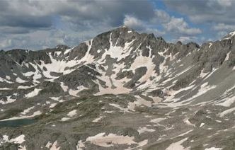
Fletcher Mountain and Drift Peak Traverse
This is an appx 6 mile, 2,800 ft elevation gain, Class 3 out and back with high exposure. The ascent starts at the Blue Lakes Trailhead North of Hoosier Pass and South of Breckenridge.
14er's .com has a detailed preview of this route. Here is the link. Combination Route - Fletcher+Drift Traverse | 14ers.com
Alternate titles -
Drift Peak - Miles - 5.50 miles (add 1.5 miles to trip if the gate to the parking area is closed) - 2,800 ft elevation gain
Class 3. Scramble. Summit: 13,951 feet.
This hike starts at the Blue Lakes trailhead ( 11,700 feet ) south of Breckenridge. From the east end of the damn follow the sometimes faint trail, gradually ascending westward into the valley, away from the lake. Near 12,300', the trail angles northwest as it goes into a high basin, west of Quandary Peak. Continue north through the basin on a good trail and reach a steep gully, near 12,500ft ,the trail ends here. Climb the left side of the gully on loose rock, then turn right and rock-hop north toward the end of the basin. Near 13,100 ft, go west and exit the basin by ascending a slope covered with large rock slabs.
Complete the climb on Fletcher's southeast ridge.
Hike 0.2 mile down Fletcher's southwest ridge to reach the Fletcher-Drift saddle. Continue towards Drift, southwest on the ridge which gradually becomes more difficult. Scramble along the ridge to reach a small section of rust-colored rock just before a large point on the ridge, a sheer drop-off lies ahead, it's best to pass the point on the right (north) side.
At this point turn right and begin a short traverse to the north. Drop slightly and locate a spot to drop into the gully on the other side of the point. You may see a bolt/ring in the rocks near this location. Drop into and cross the gully and begin scrambling up the north side of the ridge. The crux which is the notch is behind you. Regain the ridge crest. The pitch is steep near the top but you should be able to keep it at Class 3. Once back on the ridge, turn right (west) toward the summit.
For the descent retrace your route to the Drift-Fletcher saddle, from here retrace your up route to the trailhead.
Fletcher Mountain - miles 4.4 miles. (add 1.5 miles to trip if the gate to the damn parking area is closed). - 2,250 ft elevation gain
Fletcher Mountain: 13,951 feet. Class 2.
Begin this hike at the Blue Lakes trailhead ( 11,700 feet ) south of Breckenridge. From the east end of the damn follow the sometimes faint trail, gradually ascending westward into the valley, away from the lake. Near 12,300', the trail angles northwest as it goes into a high basin, west of Quandary Peak. Continue north through the basin on a good trail and reach a steep gully, near 12,500ft ,the trail ends here. Climb the left side of the gully on loose rock, then turn right and rock-hop north toward the end of the basin. Near 13,100 ft, go west and exit the basin by ascending a slope covered with large rock slabs.
Complete the climb on Fletcher's southeast ridge. Stay on the left of the ridge crest, to avoid the serious drop-offs to the east.
- Suitable Activities: Hiking, Scrambling
- Seasons: Year-round
- Weather: View weather forecast
- Difficulty: Difficult
- Length: 6.0 mi
- Elevation Gain: 2,800 ft
- 13,943 ft
- Land Manager: U.S. Forest Service
- Parking Permit Required: USFS Permits & Passes
- Recommended Party Size: 8
- Maximum Party Size: 8
- Maximum Route/Place Capacity: 8
This is a list of titles that represent the variations of trips you can take at this route/place. This includes side trips, extensions and peak combinations. Not seeing a title that fits your trip? Log in and send us updates, images, or resources.
- Fletcher Mountain
- Drift Peak
There are no resources for this route/place. Log in and send us updates, images, or resources.
