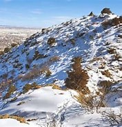
Fremont Peak
Summit Fremont Peak 7233' via via Canyon Rim, Far Out and Summit trails. Easy rolling terrain on the lower trails with progressing to moderate gain up to the saddle and a moderately challenging ascent trail to the summit. Views from the peak are spectacular including the Arkansas River, Royal Gorge Bridge, Sangre de Cristo Mountains, Pikes Peak and Canon City.
Fremont Peak makes up a sizeable section of the northeast rim of the Royal Gorge and is one of the most prominent peaks in a subrange of mountains called the Gorge Hills. Access to the Canyon Rim Trailhead is by a well maintained paved county road with free parking available in a small picnic area with a vault toilet prior to the entrance of the Royal Gorge Bridge and across the road from the trailhead. The well maintained trails to the peak are part of the Royal Gorge Park Trail System. The hike can be extended by adding additional trails including connecting to the Fremont County trail system.
Alternate titles -
- Suitable Activities: Hiking
- Seasons: Year-round
- Weather: View weather forecast
- Difficulty: moderately challenging
- Elevation Gain: 1,250 ft
- 7,233 ft
- Land Manager: Land Manager Varies
- Parking Permit Required: Other
- Recommended Party Size: 10
- Maximum Party Size: 12
- Maximum Route/Place Capacity: 12
This is a list of titles that represent the variations of trips you can take at this route/place. This includes side trips, extensions and peak combinations. Not seeing a title that fits your trip? Log in and send us updates, images, or resources.
- Fremont Peak - Royal Cascade Trail
- Fremont Peak - Canyon Rim Trail
- Fremont Peak - Summit Loop Trail
There are no resources for this route/place. Log in and send us updates, images, or resources.
