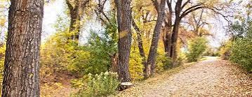
High Line Canal Trail
This 71-mile trail follows the historic High Line agricultural irrigation canal. It is a major regional trail, tying into Cherry Creek Trail, Sand Creek Trail, and many other local trails.
This trail has numerous entry and exit points all along its length. Since it was designed to follow the gravitational fall line, it is gently graded everywhere. The High Line Canal Conservancy maintains the trail, and provides trail info and maps. The canal originates just below Chatfield Dam, and proceeds through neighborhoods in Douglas, Arapahoe, Denver, and Adams County. It is mostly eight to ten feet wide and soft-surfaced but occasionally is paved toward its end, which is in sight of Denver International Airport.
- Suitable Activities: Biking, Exploring Nature, Family, Hiking
- Seasons: Year-round
- Weather: View weather forecast
- Length: 71.0 mi
- 5,553 ft
- Land Manager: Land Manager Varies
- Parking Permit Required: Other
- Recommended Party Size: 15
- Maximum Party Size: 30
- Maximum Route/Place Capacity: 30
There are no resources for this route/place. Log in and send us updates, images, or resources.
