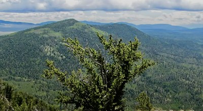
Kaufman Ridge HP and Kaufman Ridge North
The Kaufman Ridge high point, situated near Buena Vista, offers incredible views over the Collegiate Peaks.
This is an approx. 10 mile off-trail moderate hike, with 2,800' elevation gain on the Kaufman Ridge. It is part of the San Isabel National Forest and falls within the Kaufman Ridge Colorado Roadless Area (CRA).
Description from SummitPost.org: Kaufman is a 7 mile long ridgeline that forms a portion of the southwestern border of the South Park Plateau in central Colorado. The ridgeline starts at the 9346' Trout Creek Pass on Route 24/285 near the town of Buena Vista and heads southeast until it slowly merges into the South Park Plateau. The high points along the crest of the ridgeline have elevations in the 10400-10765' range. A 9450' saddle breaks the ridgeline into two pieces. The 10765' Kaufman Ridge High Point rises directly to the south of the saddle. Kaufman Ridge North is the second highest point of the ridgeline and rises to the north of the saddle.
Kaufman Ridge offers several access routes. Respect private property boundaries and adhere to seasonal closures.
1. Access via County Road 318 (Buckrake Drive/Windmill Drive): From Trout Creek Pass, take County Road 318, also known as Buckrake Drive, which transitions into Windmill Drive. These roads pass through private property before reaching the San Isabel National Forest. There is a gate that is closed from December to April, so plan your trip accordingly.
2. Access via Forest Road 307 and Forest Road 308 (Mushroom Gulch Road): From Buena Vista, drive 2 miles south on Route 24 to the intersection with Route 24/285. Head east on Route 24/285 through Johnson Village and continue for 6.3 miles until you reach Forest Road 307 on the right (south side). Turn onto Forest Road 307 and drive 2.1 miles, passing the junction with Forest Road 187, until you reach Forest Road 308 (Mushroom Gulch Road). Turn right onto 308 to approach Kaufman Ridge North. This route involves navigating forest roads that may require high-clearance vehicles.
3. Fourmile Area Off-Road Trail (FS 329): FS 329 is a short trail through the northwest end of the Kaufman Pasture, offering views of the surrounding mountain ranges and the Kaufman Pasture. It’s suitable for off-road vehicles and provides opportunities to observe local wildlife, such as pronghorn. Access to this trail may require appropriate off-road vehicles.
- Suitable Activities: Hiking
- Seasons: Year-round
- Weather: View weather forecast
- Avalanche Terrain Rating Challenging View avalanche forecast.
- Difficulty: Moderate
- Length: 10.0 mi
- Elevation Gain: 2,800 ft
- 10,765 ft
-
Land Manager:
U.S. Forest Service
Salida Ranger District (PSINF)
- Parking Permit Required: USFS Permits & Passes
- Recommended Party Size: 6
- Maximum Party Size: 12
- Maximum Route/Place Capacity: 12
- SummitPost
- Peakbagger
- Peakvisor
- ListsofJohn
This is a list of titles that represent the variations of trips you can take at this route/place. This includes side trips, extensions and peak combinations. Not seeing a title that fits your trip? Log in and send us updates, images, or resources.
- Kaufman Ridge
There are no resources for this route/place. Log in and send us updates, images, or resources.
