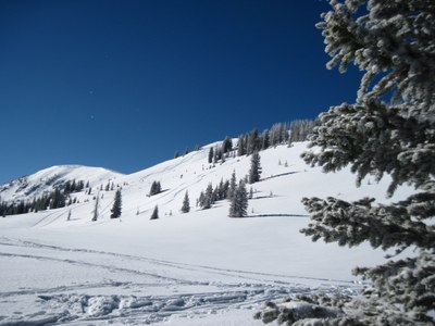
Montgomery Pass
The Montgomery Pass area has many options for on-trail and off-trail winter recreation. The Pass itself is a generally a moderate snowshoe, easy AT ski, or challenging backcountry nordic ski destination, with many alternatives and extensions available. Mostly on trail, usually skin track during the winter. It is 4 miles roundtrip with a 1500' elevation gain. Downhill portion likely off trail.
A moderate backcountry ski tour during the winter months. A moderate hike during the summer months.
The most direct and safest route to Montgomery Pass in the winter begins at the Zimmerman Lake Trailhead parking area (directions below). From the parking area, cross the road to find the beginning of the Montgomery Pass Trail just east of the parking lot. Climb the heavily used Montgomery Pass Trail for 1.3 miles to a trail junction sign. From here, take the trail to the RIGHT marked "Montgomery Pass" -- which may or may not be tracked -- approximately 0.5 miles to the actual pass. The distance and elevation gain shown below are for the 'on-trail' direct route to Montgomery Pass, there are many extensions and off-trail alternatives available for this route.
IMPORTANT NOTE: from the signed junction 1.3 miles from the trailhead, the leftward trail (to "Montgomery Bowls") leads to possible avalanche terrain. Some maps show this trail (the "Bowls Route") also going to Montgomery Pass. Although the Bowls Route tends to see more use and may be better tracked from the junction, it is NOT a safe route to Montgomery Pass during avalanche season.
Directions to Zimmerman Lake Trailhead parking area: From Ted's Place at the intersection of Hwy 287 and Hwy 14 (northwest of Fort Collins), drive west on Hwy 14 approximately 57 miles to the large parking lot on the left hand side of the road. Coming from the west, the parking lot is approximately 7 miles east of Cameron Pass.
- Suitable Activities: Backcountry Nordic Skiing, Backcountry Skiing/Splitboarding, Snowshoeing
- Snowshoeing Category: Intermediate
- Seasons: January, Year-round, February, March, April, May, November, December
- Weather: View weather forecast
- Avalanche Terrain Rating Simple View avalanche forecast.
- Difficulty: Easy B
- Length: 4.0 mi
- Elevation Gain: 1,500 ft
- 11,400 ft
-
Land Manager:
U.S. Forest Service
Canyon Lakes Ranger District (ARNF)
- Parking Permit Required: USFS Permits & Passes
- Recommended Party Size: 12
- Maximum Party Size: 24
- Maximum Route/Place Capacity: 24
There are no resources for this route/place. Log in and send us updates, images, or resources.
