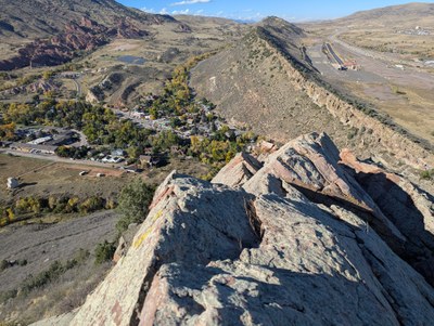
Mt Glennon
Class 3 scrambling with some exposure. Knife edge ridges, steep smooth slabs, chimneys, short faces, caves and treacherous gravel on smooth rock. All in 1.7 miles and 760' of vertical. Trailhead 1/2 mile from C-470 and Morrison Road.
The idea of doing this is to have as much fun as possible in a short exposed ridgeline. The ridgeline is riddled with small boulder problems and cool features and great views of Red Rocks and Mt Falcon Parks.
- Seasons: Year-round
- Weather: View weather forecast
- Avalanche Terrain Rating Simple
- Length: 1.7 mi
- Elevation Gain: 760 ft
- 6,458 ft
- Land Manager: Jefferson County Open Space
- Parking Permit Required: Other
- Recommended Party Size: 8
- Maximum Party Size: 14
- Maximum Route/Place Capacity: 14
This is a list of titles that represent the variations of trips you can take at this route/place. This includes side trips, extensions and peak combinations. Not seeing a title that fits your trip? Log in and send us updates, images, or resources.
- Mt Glennon
There are no resources for this route/place. Log in and send us updates, images, or resources.
