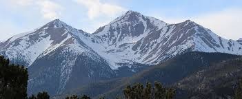
Mt Yale
Mt. Yale is one of Colorado's 14er's (14, 196 feet)
Mt. Yale is one of Colorado's 14er's (14, 196 feet). The start of the TH is called Denny Creek Trailhead located off of County Road 306, west of Buena Vista. The trail travels northeast crossing Denny Creek and ascends to Delaney Gulch and up the southwest ridge of the peak. County Road 306 is closed by snow from November through May.
Mt. Yale is in the Collegiate Peaks Wilderness Area. Please read all regulations associated with this wilderness area.
Group size is limited to 15 people.
Alternate title -
Denny Creek TH - 9.5 miles - 4,200 ft elevation gain
- Suitable Activities: Hiking
- Seasons: June, July, August, September, October
- Weather: View weather forecast
- Difficulty: Difficult
- Length: 9.5 mi
- Elevation Gain: 4,200 ft
- 14,200 ft
-
Land Manager:
U.S. Forest Service
Collegiate Peaks Wilderness Area, Salida Ranger District (PSINF)
- Parking Permit Required: Other
- Recommended Party Size: 12
- Maximum Party Size: 15
- Maximum Route/Place Capacity: 15
- caltopo
- All Trails
This is a list of titles that represent the variations of trips you can take at this route/place. This includes side trips, extensions and peak combinations. Not seeing a title that fits your trip? Log in and send us updates, images, or resources.
- Mt. Yale - Denny Creek TH
There are no resources for this route/place. Log in and send us updates, images, or resources.
