Rosalie Peak
Rosalie Peak is a 13'er located south of Mount Blue Sky in the Mount Blue Sky Wilderness.
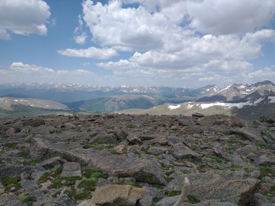
Climbing Rosalie (13,575') takes one through the Mt Blue Sky Wilderness and offers great views of Mt Bierstadt, Mt Evans, and Square Top. The trail begins near Bailey at the Deer Creek Trailhead and follows the Tanglewood Creek Trail. (Click to see that Route & Place.)
Alternative Titles:
Rosalie Peak via Tanglewood Creek Trail and Pegmatite Points: Near treeline, the trail passes through a stand of bristlecone pines, and then goes up to Pegmatite Points. From Pegmatite Points, the hike goes off-trail for about a mile off-trail to the summit. The return is along the same path - 11 miles, 4,300' gain
Rosalie Peak and Epaulet Mountain (13,523'): Park off the Mt. Evans Hwy past Summit Lake and proceed south one mile to Epaulet and Epaulet summits. Go SE one mile up the ridgeline to Rosalie Peak. Loop back below Epaulet to the TH. Lots of up and down, all above 13000 feet - 5 miles, 1,600' gain
Rosalie Bandit Loop: Starting from the Deer Creek Trailhead, the Rosalie-Bandit Loop gains the summits of both Rosalie and Bandit Peak (12,453'). About half on-trail and half off-trail hiking. From the top of Rosalie back to the trailhead is off trail. Portions of the off-trail hiking are steep and route finding is required - 10.5 miles, 4300' gain.
- Suitable Activities: Hiking
- Seasons: June, July, August, September
- Weather: View weather forecast
- View avalanche forecast.
- 13,575 ft
-
Land Manager:
U.S. Forest Service
Mount Blue Sky Wilderness Area (formerly Mount Evans), South Platte Ranger District (PSINF)
- Parking Permit Required: USFS Permits & Passes
- Recommended Party Size: 12
- Maximum Party Size: 15
- Maximum Route/Place Capacity: 15
- 14ers.com
- climb13ers.com
- Peakbagger.com
- Lists of John
- AllTrails
- AllTrails
This is a list of titles that represent the variations of trips you can take at this route/place. This includes side trips, extensions and peak combinations. Not seeing a title that fits your trip? Log in and send us updates, images, or resources.
- Rosalie Peak - Rosalie and Epaulet
- Rosalie Peak - Tanglewood Creek Trail and Pegmatite Points
- Rosalie Peak - Rosalie-Bandit Loop
There are no resources for this route/place. Log in and send us updates, images, or resources.
