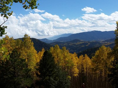
Rudolph Mountain Trail
Rudolph Mountain, 10,334'. A prominent peak in the central Wet Mountain. The trail climbs 2400' in 4.5 miles, often steeply. Aspen groves are especially awesome in autumn.
The start of the trail is badly burned, but has been roughly re-routed in places, as it climbs steeply up School Section Draw. It crosses a ridge, topped by aspen grove, descends slightly, then follows a swale to another ridge. The trail disappears here, but climb to a low ridge. From here, there is a scant trail & occasional tags as you climb the obvious hill, through another aspen grove. The trail is not always well maintained, and care should be taken to stay on it.
- Suitable Activities: Hiking
- Seasons: Year-round
- Weather: View weather forecast
- Difficulty: Mod C
- Length: 8.5 mi
- Elevation Gain: 2,700 ft
- 10,334 ft
-
Land Manager:
U.S. Forest Service
San Carlos Ranger District (PSINF)
- Parking Permit Required: USFS Permits & Passes
- Recommended Party Size: 12
- Maximum Party Size: 12
- Maximum Route/Place Capacity: 12
- USGS Hardscrabble
- Usgs wetmore
There are no resources for this route/place. Log in and send us updates, images, or resources.
