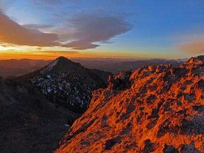
Twin Sisters and South Sister
This Moderate C hike of 9 miles and 3,000' will get us to three summits: the Twin Sisters (West and East) and their seldom-climbed sibling to the south.
Twin Sisters is a popular summit destination in Rocky Mountain National Park. Our hike will reach the summits of the popular West Sister (11,413'), the higher East Sister (11,428'), and we'll try to tag the more remote South Sister (11,376').
The hike begins at the Twin Sisters Trailhead off of Hwy 7 at Lily Lake. If the gate is open, drive up the road and park as high as you can. The trailhead is farther up the dirt access road well above the parking area. In winter months, a gate closes the road and you must park in the lot on Hwy 7. Parking here will add a mile to the overall length of the trip.
The trail climbs steadily and will cross the huge landslide from the 2013 Flood. You'll get occasional views of Longs Peak. Eventually a saddle is reached before the trail continues up above treeline. The views will open up to the north as the trail switchbacks across a talus field. Just below the summit, we'll come across a rock hut containing communications gear. The trail continues to the top of the West Sister. There was once a fire lookout tower here and the anchors can still be seen. The West Sister is the popular one because it looks across the Tahosa Valley at the East Face of Longs Peak.
Leaving the West Sister, we'll rock-hop and scramble to the higher East Sister. Occasionally, there is a summit register here but it keeps getting removed. From this perch, the South Sister is obvious as is the way to get to it. There is no trail or marked route to it, but we won't need it. We'll just follow the obvious rock wall to its superb little summit.
There are three options for the return: (1) the way we came, (2) contour around the eastern flank of the East Sister and rejoin the standard trail in the talus field, or, (3) climb the obvious slope towards the rock hut and rejoin the standard trail.
- Suitable Activities: Hiking, Snowshoeing, Trail Running
- Snowshoeing Category: Intermediate
- Seasons: Year-round
- Weather: View weather forecast
- Difficulty: Mod C
- Length: 8.7 mi
- Elevation Gain: 3,000 ft
- 11,428 ft
-
Land Manager:
Land Manager Varies
Rocky Mountain National Park, Canyon Lakes Ranger District (ARNF)
- Parking Permit Required: National Park Entrance Fees
- Recommended Party Size: 12
- Maximum Party Size: 12
- Maximum Route/Place Capacity: 12
There are no resources for this route/place. Log in and send us updates, images, or resources.
