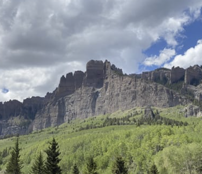
West Elk Peak
A beautiful and remote Elk Range 13'er with out of this world aspens.
West Elk Peak (13035') is the highest mountain of both the West Elk Range and the West Elk Wilderness. It is located south of Kebler Pass.
Alternate Titles:
Via Storm Pass, from the Mill Creek TH (north). Via Mill Creek Rd (USFS #727) and Mill Castle Trail (USFS #450). All class 1. There is a campsite at the trailhead, as well as others a mile or two in from the wilderness boundary. Higher campsites are to be found about 6.5 miles from the trailhead. 18 miles, 4000' gain.
South Ridge Approach Route starts at Rainbow Lake Trailhead, and following the Rainbow Lake Trail (USFS #449) west of Gunnison on US-50. The TH can be accessed by most passenger vehicles, driven slowly and carefully on a wash-boarded road. Some Class 2 scrambling. 10 miles, 4000' gain.
- Suitable Activities: Backpacking, Hiking, Scrambling
- Seasons: June, July, August, September, October
- Weather: View weather forecast
- View avalanche forecast.
- 13,035 ft
-
Land Manager:
U.S. Forest Service
West Elk Wilderness Area, Gunnison Ranger District (GMUG)
- Parking Permit Required: USFS Permits & Passes
- Recommended Party Size: 10
- Maximum Party Size: 10
- Maximum Route/Place Capacity: 10
- SummitPost
- CoTrex
- 14ers.com
- climb13ers.com
- AllTrails
- AllTrails
This is a list of titles that represent the variations of trips you can take at this route/place. This includes side trips, extensions and peak combinations. Not seeing a title that fits your trip? Log in and send us updates, images, or resources.
- West Elk Peak - via Storm Pass
- West Elk Peak - via Rainbow Lake TH
There are no resources for this route/place. Log in and send us updates, images, or resources.
