Trip
Hiking – Bald Mountain
- Mon, Jul 28, 2025
- Bobcats Section
- Hiking
- Adults
- Challenging
- Challenging
- Mileage: 10.2 mi
- Elevation Gain: 3,100 ft
- High Point Elevation: 13,684 ft
- Pace: Moderate (1.8 - 2.0 avg moving speed)
- FULL, 2 on waitlist (7 capacity)
- Cancellation & Refund Policy
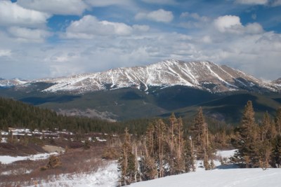
This is an out and back hike along a dirt road, then along the north ridge of Bald Mountain to its 13,684 ft summit. On the way up to the ridgeline, we will pass by several old mines. According to AllTrails: “Highlights include stunning views, beautiful wildflowers, and a quiet atmosphere. Challenges mentioned are steep inclines, loose rocks, and navigating the trail.”
Here's a link to the Bald Mountain Trail in AllTrails: https://www.alltrails.com/trail/us/colorado/bald-mountain
Meet at Wooly Mammoth - Section BB, across from the Exxon gas station, at 6:00am, so we can form carpools and leave no later than 6:10am. Here’s a Google Maps link to the “Wooly Mammoth Park-N-Ride”: https://maps.app.goo.gl/ureNbXygtrukNp8fA
The trailhead is the Baldy Trailhead in Breckenridge. It is at the intersection of Baldy Rd, Goldenview Dr, and County Road 536. Here’s a Google Maps link to the “Baldy Mountain Trail Head”: https://maps.app.goo.gl/6HwJzB4ciUXzVRtQ9
Required Equipment
Bring your 10 essentials
