Trip
Hiking – Brainard Lake Rec Area - Long Lake TH - Pawnee and Shoshoni Peaks
- Thu, Aug 28, 2025
- Bobcats Section
- Hiking
- Adults
- Challenging
- Difficult
- Mileage: 12.0 mi
- Elevation Gain: 3,200 ft
- High Point Elevation: 12,967 ft
- Pace: Moderate (1.8 - 2.0 avg moving speed)
- 8 (7 capacity)
- Cancellation & Refund Policy
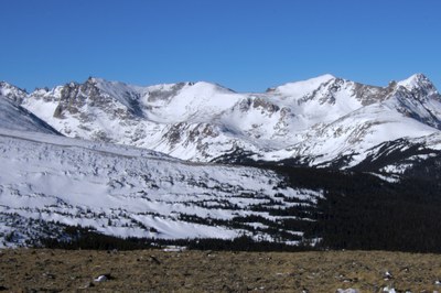
From the Long Lake Trailhead, we will follow the Pawnee Pass Trail 4.5 miles to Pawnee Pass. From there we will follow the ridge 0.5 miles north to Pawnee Peak. Then we will head 1.5 miles south, back across Pawnee Pass along the ridgeline to Shoshoni Peak. There are some steep sections and the hike is generally over loose rocks and boulders / boulderfields along the ridgeline between Pawnee and Shoshoni Peaks.
Note that parking at the Brainard Lake parking lot, instead of at Long Lake TH, adds about 2 miles to the roundtrip.
Here's a link to the “Pawnee Peak via Pawnee Pass Trail” in AllTrails: https://www.alltrails.com/trail/us/colorado/pawnee-pass-trail
Here’s a link to the “Shoshoni Peak via Pawnee Pass Trail” in AllTrials: https://www.alltrails.com/trail/us/colorado/shoshoni-peak-via-pawnee-pass-trail
Meet at the parking lot at Plainview Rd and Coal Creek Canyon Rd (CO Hwy 72) at 6:00am, so we can form carpools and leave no later than 6:10am. This is 1.7 miles west of the intersection of CO 72 and CO 93. Here is a Google Maps link to the parking lot meeting place at “9881 Plainview Rd, Arvada”: https://maps.app.goo.gl/NAgUWeDQCrMcF4UM9
The trailhead for this hike is the Long Lake Trailhead just west of Brainard Lake. Here’s a Google Maps link for the “Long Lake Trail Head”: https://maps.app.goo.gl/5X61RzyJgTFjhkC5A
Required Equipment
Please bring your 10 essentials
