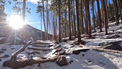
BPX 2-Day: Wind River Basin from East Portal TH (RMNP)
This moderate out-and-back trip into the Wind River Basin of Rocky Mountain National Park (RMNP) is approximately 3.2 miles and 600 vertical feet of elevation. The Wind River Basin in RMNP refers to a geographic area within the park where the Wind River flows, primarily accessible from the East Portal Trailhead, and is known for its scenic hiking trails.
Suggested Backpacking Section (BPX) itinerary for 2-day trip to be used for CMC trips led by BPX leaders for BPX members:
Day 1. Starting at East Portal Trailhead hike on the Wind River Trail to a location above the Over the Hill campsite and establish camp. (1.6 miles / +600 ft.). Alternate sites are available along the Wind River Trail so long as they are at least 1 mile from the trailhead, out of site of the trail, and 200 feet from water and established campsites. Optional night hike along local trails.
Day 2. Return to trailhead (1.6 miles / -650 ft.).
Notes:
- Please view this document with everything you need to know about Rocky Mountain National Park
- For information on obtain a RMNP wilderness camping permit, click on this LINK.
- During the winter season (late Oct-late May), campsites are available on a first-come, first-served basis only.
- Includes the option for side trips and exploration off-trail.
- Suitable Activities: Backpacking
- Seasons: Year-round
- Weather: View weather forecast
- Difficulty: Moderate
- Length: 3.2 mi
- Elevation Gain: 600 ft
- 8,867 ft
- Land Manager: National Park Service
- Parking Permit Required: National Park Entrance Fees
- Recommended Party Size: 12
- Maximum Party Size: 12
- Maximum Route/Place Capacity: 12
There are no resources for this route/place. Log in and send us updates, images, or resources.
