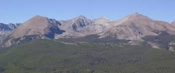
Mount Helen
Mt Helen is a 13'er in the Ten Mile Range, near Breckenridge on the west side of CO-9, north of Quandary Peak and McCullough Gulch.
There are two approaches to this 13,186' peak. The most common, east side approach begins at the Spruce Creek Trailhead. RT Hike: 5.1 miles, 2,700' gain. See SummitPost.org for both a climbing route and a ski descent route.
Per 14ers.com it is also possible to start a hike on the south end of the Aqueduct road that runs between Spruce Creek and Crystal Creek.
- Suitable Activities: Hiking, Scrambling, Ski Mountaineering
- Seasons: Year-round
- Weather: View weather forecast
- Avalanche Terrain Rating Challenging View avalanche forecast.
- Difficulty: challenging
- Length: 5.1 mi
- Elevation Gain: 2,700 ft
- 13,186 ft
-
Land Manager:
U.S. Forest Service
Dillon Ranger District (WRNF)
- Parking Permit Required: USFS Permits & Passes
- Recommended Party Size: 12
- Maximum Party Size: 12
- Maximum Route/Place Capacity: 12
- summitpost
- 14ers.com
- COTREX
This is a list of titles that represent the variations of trips you can take at this route/place. This includes side trips, extensions and peak combinations. Not seeing a title that fits your trip? Log in and send us updates, images, or resources.
- Spruce Creek TH
- Aquaduct Rd
There are no resources for this route/place. Log in and send us updates, images, or resources.
